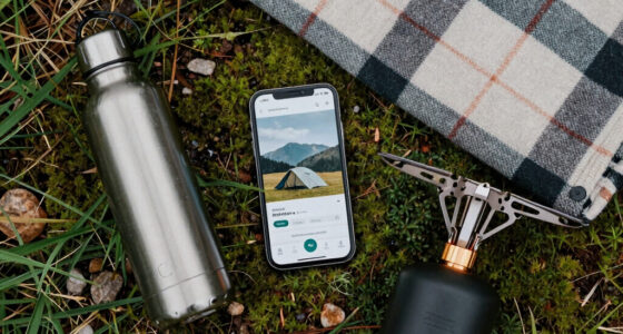

When steering through fog or whiteouts where visibility drops to near zero, advanced tech like satellite imaging and augmented reality are essential. Satellite images offer real-time terrain and obstacle data, while AR overlays critical navigation cues directly onto your view. This combination helps you stay oriented and on course despite environmental challenges. Using these tools, you gain reliable positioning and clear guidance, ensuring safety. If you keep exploring, you’ll discover more about how these innovations transform navigation in extreme conditions.
Key Takeaways
- Satellite imaging offers real-time terrain data, ensuring accurate positioning when visual cues are obscured by fog or whiteouts.
- Augmented reality overlays critical navigation information directly onto the user’s view, aiding orientation in near-zero visibility.
- Combining satellite imagery with AR reduces reliance on traditional instruments that may drift or fail in low visibility conditions.
- These integrated technologies enhance safety and precision for aviation, maritime, and off-road navigation in obscured environments.
- Real-time visual data and virtual guidance enable confident decision-making despite environmental opacity.

When visibility drops to near zero, advanced navigation technology becomes indispensable for safety and accuracy. In conditions like thick fog or whiteouts, your ability to see landmarks, terrain features, or even the path ahead diminishes rapidly. That’s where satellite imaging and augmented reality come into play, transforming how you navigate through obscured environments. Satellite imaging provides detailed, real-time maps of your surroundings, allowing you to visualize terrain, obstacles, and waypoints even when they’re hidden from view. This technology captures high-resolution images from space, offering an extensive perspective that ground-based signals can’t match in low-visibility conditions. By integrating satellite data with your navigation systems, you get a dependable source of positional information, reducing the risk of veering off course or encountering unseen hazards.
In near-zero visibility, satellite imaging ensures precise navigation through obscured environments.
Augmented reality further enhances your situational awareness, overlaying critical navigation data directly onto your field of view. Imagine wearing a heads-up display or using AR glasses that project virtual markers, directional arrows, and hazard warnings onto your environment. When visibility is compromised, these overlays act as a virtual guide, helping you stay oriented and on track. You can see the exact location of your destination, nearby obstacles, or safe pathways without needing to rely solely on auditory cues or traditional instruments. This seamless integration of real-world imagery and digital information allows you to make quick, confident decisions, even when the environment is virtually opaque.
Together, satellite imaging and augmented reality create a robust navigation system that compensates for the lack of visual cues. Satellite images update regularly, giving you current terrain data, while AR displays guarantee that vital information is always accessible at a glance. The integration of satellite imaging and AR is especially valuable in aviation, maritime, and off-road scenarios, where the consequences of disorientation can be severe. You no longer have to depend solely on compass readings or inertial navigation, which can drift over time or become inaccurate without visual reference points. Instead, you get a layered approach that maintains precision, even under the most challenging conditions.
Ultimately, these advanced technologies empower you to navigate safely through near-zero visibility environments. They provide reliable positioning, real-time visual data, and intuitive guidance, all integrated into a user-friendly interface. As a result, you can focus more on your task and less on the uncertainty of what lies ahead, ensuring safer journeys through fog, whiteouts, or other obscured conditions.

GPS Module Receiver,Navigation Satellite Positioning NEO-6M (Arduino GPS, Drone Microcontroller, GPS Receiver) Compatible with 51 Microcontroller STM32 Arduino UNO R3 with Antenna High Sensitivity
With a USB interface, you can directly use the phone data cable on the computer point of view…
As an affiliate, we earn on qualifying purchases.
As an affiliate, we earn on qualifying purchases.
Frequently Asked Questions
How Do Sensors Perform in Extreme Weather Conditions?
Sensors can perform well in extreme weather conditions if they have high sensor accuracy and weather resilience. You’ll find that radar and lidar sensors often excel because they penetrate fog and snow better than cameras. Still, you should be aware that severe weather can reduce sensor effectiveness, so combining multiple sensor types and using advanced algorithms helps maintain reliable navigation when visibility drops near zero.
What Are the Limitations of Current Fog Navigation Technology?
Did you know that fog navigation tech struggles with over 30% of signal interference incidents? You’ll find that current fog navigation technology is limited by sensor calibration issues, which can cause inaccurate readings. Additionally, heavy signal interference from environmental factors hampers reliability. These limitations mean you might not always get precise navigation, especially in dense fog or whiteout conditions, requiring you to rely on supplementary methods for safety.
How Do GPS Signals Behave During Heavy Fog?
During heavy fog, GPS signals can be disrupted by signal interference from moisture and atmospheric conditions, leading to reduced accuracy. You should verify your GPS device has proper sensor calibration to improve reliability. Keep in mind that dense fog may cause temporary signal loss or delays, so it’s wise to use additional navigation tools like inertial sensors or visual cues. Always stay alert and double-check your position when visibility is near zero.
Can Drone Technology Improve Visibility Navigation?
Drone technology can definitely improve visibility navigation, like a lighthouse guiding ships through fog. With autonomous flight capabilities, drones can navigate complex environments even in low visibility. They rely on advanced sensors that enhance accuracy, helping them detect obstacles and terrain precisely. This combination allows drones to operate safely where human vision falters, making them invaluable for search and rescue, surveillance, and environmental monitoring in challenging conditions.
What Training Is Required for Operators Using These Systems?
You need operator certification and simulation training to effectively use guidance systems in fog and whiteouts. Certification ensures you’re qualified, understanding system functionalities and safety protocols. Simulation training allows you to practice steering near-zero visibility conditions in a controlled environment, building your skills and confidence. Both are essential for safe operation, helping you respond accurately to unpredictable scenarios while minimizing risks during real-world missions.

Fehlertolerante Anzeigengestaltung für Augmented Reality Head-up-Displays: Bewertung und Kompensation von Registrierungsfehlern im automobilen Kontext (AutoUni – Schriftenreihe) (German Edition)
As an affiliate, we earn on qualifying purchases.
As an affiliate, we earn on qualifying purchases.
Conclusion
As the fog thickens and whiteouts swallow the horizon, remember that navigation technology acts like a guiding lighthouse in the storm. It cuts through the shadows and whispers of uncertainty, steering you safely when sight fails. With these tools in your hands, you’re not lost in the fog but dancing with it, confident that even in near-zero visibility, you hold the power to find your way home. Trust the tech—your beacon through the haze.

ARTILAURA GPS Speedometer Inclinometer Off-Road Angle Slope Meter Altimeter Tilt Car Overspeedometer Alam
【Function】A smart multi-functional GPS speedometer for driving. Automatically monitor vehicle driving conditions and equipped with an overspeed alarm…
As an affiliate, we earn on qualifying purchases.
As an affiliate, we earn on qualifying purchases.

Nautilus LifeLine Marine Rescue GPS nexGen
“Distress Alert” for emergencies and “Position Advisory for non-emergencies. Functionality may vary in some European countries.
As an affiliate, we earn on qualifying purchases.
As an affiliate, we earn on qualifying purchases.