
Your device uses multiple satellite systems like GPS, GLONASS, and Galileo to get the most accurate location data possible. Combining signals from these constellations helps overcome obstructions, atmospheric interference, and satellite issues, ensuring reliable positioning. This multi-constellation approach also improves precision and speed. As you explore further, you’ll discover how advanced processing makes these systems work together seamlessly to keep you connected wherever you go.
Key Takeaways
- Multiple satellite systems like GPS, GLONASS, and Galileo provide overlapping signals for better coverage worldwide.
- Using multiple constellations improves positioning accuracy and reliability, especially in challenging environments.
- Signal integration from various GNSS enhances resistance to obstructions, atmospheric disturbances, and interference.
- Devices combine data from different systems with advanced algorithms for real-time, precise location information.
- Multi-constellation use ensures continuous, more accurate navigation services regardless of environmental conditions.
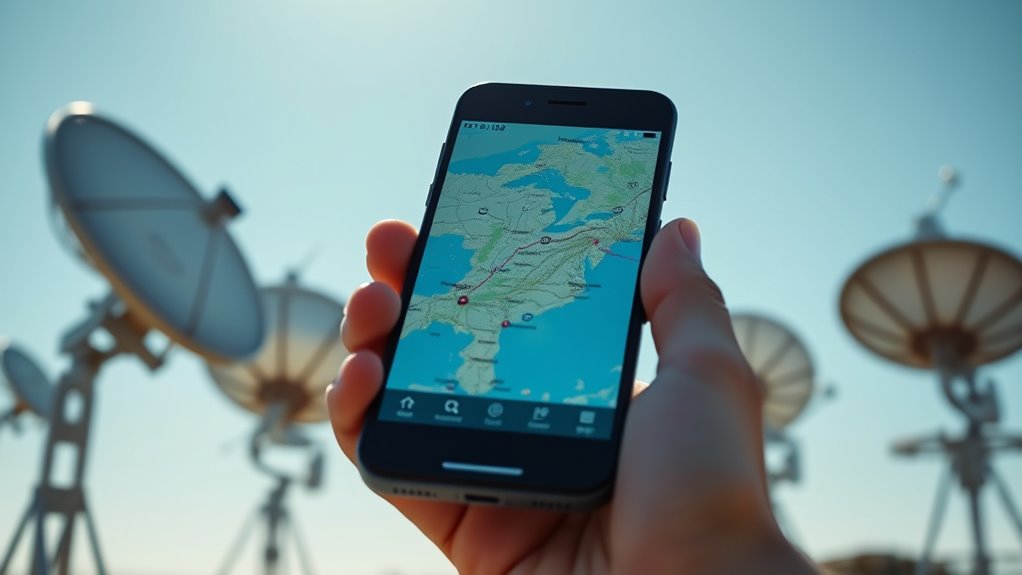
Have you ever wondered how your smartphone pinpoints your exact location? It’s easy to take for granted the complex technology behind those little maps and navigation apps. At the core of it all is GNSS—Global Navigation Satellite System—which combines signals from multiple satellite constellations like GPS, GLONASS, and Galileo. These systems work together to give you precise positioning data, but understanding how they do this helps you appreciate their significance in everyday life.
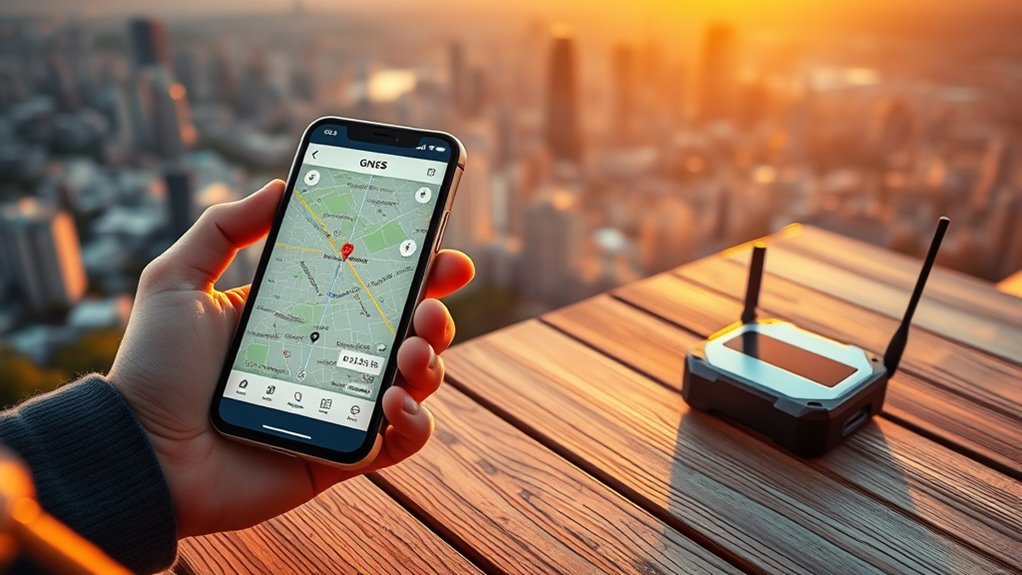
Satellite signal accuracy is vital in determining your position. When you use your device to find your way, it receives signals from a network of satellites orbiting Earth. The accuracy of these signals depends on multiple factors, including satellite geometry, atmospheric conditions, and signal interference. To improve this, modern devices leverage positioning system integration, combining data from different satellite systems to enhance reliability and precision. By integrating signals from GPS, GLONASS, and Galileo, your device can cross-verify information, reducing errors caused by obstructions or atmospheric disturbances, and providing a more consistent location fix.
Positioning system integration is why your smartphone can work seamlessly across different regions and environments. For instance, when GPS signals weaken in urban canyons or dense forests, signals from GLONASS or Galileo can fill in the gaps, maintaining accuracy. This multi-constellation approach ensures that your device can adapt to various conditions, providing a smooth navigation experience. It also means that your device’s location services are resilient—if one satellite system faces issues or signal degradation, others can compensate, ensuring continuous service.
Furthermore, the integration of multiple satellite signals enables your device to perform faster and more precise positioning. It’s not just about having more satellites in view but about how your device processes these signals collectively. Advanced algorithms analyze the data from different systems, correcting for potential errors and improving satellite signal accuracy. This real-time data processing involves sophisticated positioning system integration techniques, allowing your device to deliver accurate location information almost instantaneously.
In essence, the synergy between satellite signal accuracy and positioning system integration is what makes modern navigation so reliable. Whether you’re driving through a city, hiking in remote areas, or simply finding a nearby coffee shop, these systems work behind the scenes to keep you on track. They allow your device to leverage the best of multiple satellite networks, ensuring that your location data is as accurate as possible, no matter where you are. Understanding satellite constellations and the way they work is fundamental to appreciating how your device’s positioning capabilities are so robust and dependable. This seamless integration is what transforms satellite signals into practical, everyday navigation tools, helping you move through the world with confidence.

Garmin MSC 10 Marine Satellite Compass, Easy-to-Install, Multi-Band GNSS and Multi-Constellation Receiver, (010-02407-00)
Built-in attitude and heading reference system to filter and smooth GPS-derived heading
As an affiliate, we earn on qualifying purchases.
As an affiliate, we earn on qualifying purchases.
Frequently Asked Questions
How Do GNSS Signals Penetrate Buildings and Urban Areas?
GNSS signals penetrate buildings and urban areas by using building penetration capabilities, allowing signals to pass through walls and structures. However, their strength can weaken due to signal reflection off surfaces like glass and metal, which can cause multipath errors. To improve accuracy indoors or in dense environments, your device may combine GNSS data with other sensors, like accelerometers, to compensate for signal disruptions caused by reflection and penetration issues.
What Is the Accuracy Difference Between GPS, GLONASS, and Galileo?
You’ll notice Galileo generally offers better signal precision and system reliability than GPS or GLONASS, often providing accuracy within 1 meter. GPS is widely used but can be less reliable in urban areas, while GLONASS may have slightly lower precision but works well in northern regions. Combining signals from all three systems enhances your device’s overall accuracy and reliability, especially in challenging environments.
How Do Devices Choose Which GNSS System to Use?
You might think your device always picks the best GNSS system, but it actually prioritizes signals based on device compatibility and signal strength. When multiple systems are available, it chooses the strongest or most reliable signals first, switching seamlessly if needed. This dynamic signal prioritization guarantees you get accurate positioning, regardless of whether GPS, GLONASS, or Galileo provides the best coverage in your current location.
Can Multiple GNSS Systems Operate Simultaneously on a Device?
Yes, your device can operate multiple GNSS systems simultaneously. This multisystem compatibility allows it to access signals from GPS, GLONASS, and Galileo at once, improving accuracy and reliability. Signal synchronization guarantees these signals work together smoothly, providing more precise positioning data. By leveraging multiple systems, your device can navigate better in challenging environments, like urban canyons or dense forests, where signals might otherwise be obstructed.
What Are the Environmental Impacts of GNSS Satellite Launches?
You should know that GNSS satellite launches impact the environment through satellite emissions and launch debris. These emissions contribute to atmospheric pollution, while leftover debris can pollute oceans and land. Launches also require significant energy, increasing carbon footprints. Responsible space agencies try to minimize these effects by designing cleaner launch technologies and managing debris carefully, but environmental impacts remain a concern with frequent satellite deployments.
Harper Grove Cell Phone Internal Antenna Signal Reception Booster, 3 Pack, for Android Alcatel Apple BlackBerry LG Microsoft Motorola ZTE
Improves the signal strength of your device
As an affiliate, we earn on qualifying purchases.
As an affiliate, we earn on qualifying purchases.
Conclusion
Now that you understand how GNSS works, how GPS, GLONASS, and Galileo enhance your device’s accuracy, and why they matter, you can appreciate the technology behind your everyday navigation. You rely on them to guide you, to locate you, and to connect you. With each satellite system, each signal, and each update, your device becomes smarter, faster, and more reliable. Embrace the technology that guides, connects, and empowers you every time you navigate.

ZL180 Handheld GPS for Surveying, High Precision Rugged Land Surveying Equipment for Ranches, Garden, Farmland and Parking Area Distance Measuring
HIGH PRECISION ACCURACY: 2 high sensitivity satellites global GPS + GLONASS coverage for reliable surveying around the world,…
As an affiliate, we earn on qualifying purchases.
As an affiliate, we earn on qualifying purchases.

Garmin GLO 2 GPS and GLONASS Receiver for Precise Position Information on Mobile Devices, Black
Connects wirelessly to your mobile device: iPad, iPhone and other Bluetooth enabled smartphones, tablets and laptops to provide…
As an affiliate, we earn on qualifying purchases.
As an affiliate, we earn on qualifying purchases.