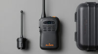
To build a layered navigation system for wilderness trips, combine GPS devices, traditional trail markings, and map skills. Carry updated GPS units with long-lasting batteries and backup chargers, and always verify signals. Use physical markers like cairns and blazes as reliable back-ups, especially in dense forests. Practice reading maps and deploying a compass alongside electronic tools. When you integrate these layers, you create a safer, more reliable navigation plan—learn more about mastering each element in the sections ahead.
Key Takeaways
- Integrate GPS devices, traditional trail markers, maps, and compasses to create multiple backup navigation methods.
- Regularly update electronic devices and maintain physical markers for reliability in diverse conditions.
- Use high-contrast trail markings and screen displays to ensure visibility in various lighting environments.
- Practice map-reading and compass skills alongside electronic navigation to strengthen overall situational awareness.
- Prepare emergency strategies that incorporate all tools, ensuring safety if primary methods fail.
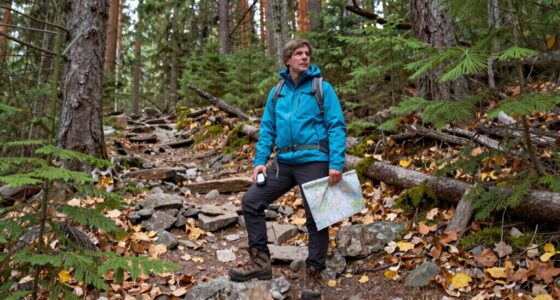
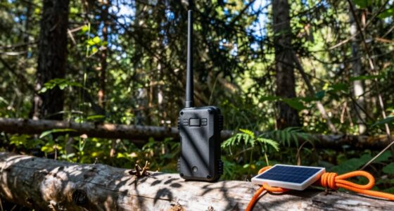
When venturing into the wilderness, having a reliable navigation system can mean the difference between a safe journey and getting lost. Building a layered navigation system means combining multiple tools and techniques to ensure you can always find your way, regardless of conditions. Start with GPS integration, which provides real-time location data and helps you track your route. Modern GPS devices can overlay your position on digital maps, making it easier to see your surroundings and plan your next move. Ensure your GPS is updated and has a long-lasting battery, and consider carrying a portable charger. Don’t rely solely on electronic devices—technology can fail due to dead batteries or signal loss.
Next, incorporate traditional navigation methods, such as trail marking. Trail marking involves creating physical references along your route, such as cairns, flagging tape, or painted blazes on trees. These markers serve as visual cues that confirm you’re on the right path and help you retrace your steps if needed. When marking trails, be consistent in your symbols and colors, and keep markers clear and visible. Use natural features like rocks or distinctive trees to support your trail markings, making them easier to spot from a distance. Trail marking acts as a backup to electronic devices, especially in dense forests or rugged terrain where GPS signals can weaken. Additionally, understanding the importance of contrast ratio in your navigation tools can help you assess the visibility of trail markings and screen displays in various lighting conditions, ensuring your markers remain effective throughout your journey. Maintaining awareness of emergency preparedness can further enhance your safety, preparing you to handle unexpected situations during your trip.
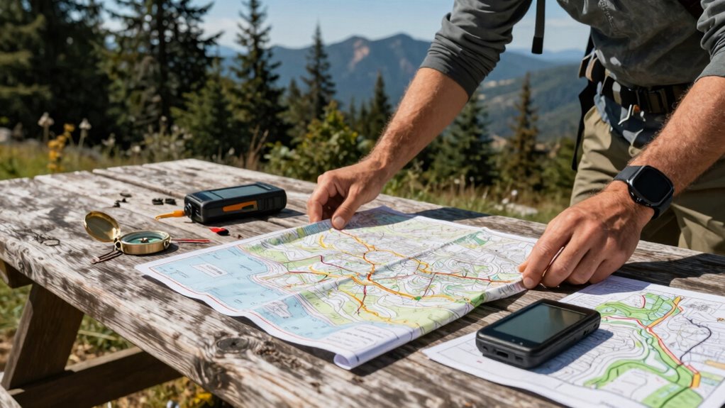
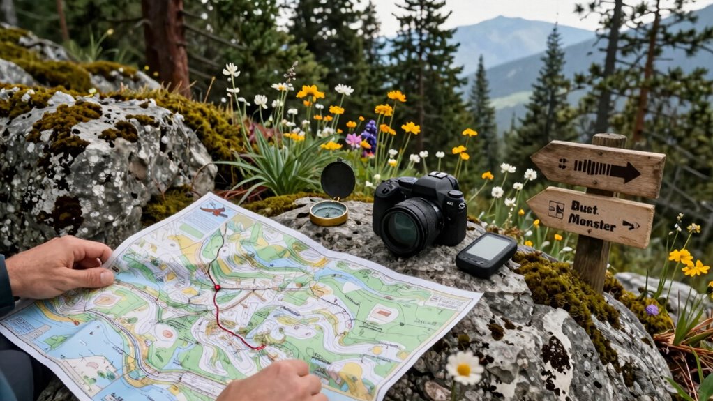
To further reinforce your layered system, carry detailed topographic maps and a compass. Maps provide an overview of the terrain, showing elevation changes, water sources, and landmarks, while a compass helps you orient yourself accurately. Practice your map-reading and navigation skills before your trip, so you’re comfortable using these tools in the field. When used together, GPS, trail marking, maps, and compass form a robust system that compensates for each other’s weaknesses. For instance, if your GPS fails, your physical trail markers and map can guide you safely back to known points. Conversely, if visibility drops and trail markers become obscured, your GPS and map can help you stay oriented.

Garmin 010-02256-00 eTrex 22x, Rugged Handheld GPS Navigator, Black/Navy
Explore confidently with the reliable handheld GPS
As an affiliate, we earn on qualifying purchases.
As an affiliate, we earn on qualifying purchases.
Frequently Asked Questions
What Are the Essential Tools Needed for Layered Navigation in Wilderness Trips?
You need digital maps and a compass for layered navigation in wilderness trips. Digital maps help you plan routes and visualize terrain, while a compass allows for precise navigation when electronic devices fail. Make sure your digital maps are up-to-date and your compass is properly calibrated. Carry extra batteries or power sources for digital devices, and practice using both tools together to stay confident and safe in the wilderness.
How Do Weather Conditions Affect Layered Navigation System Effectiveness?
When weather turns sour, it can throw a wrench in your plans, greatly impacting navigation accuracy. Weather impact, like fog, rain, or snow, reduces visibility and interferes with GPS signals, making it harder to rely solely on tech tools. You need to adapt your layered navigation system accordingly, using terrain features and compass skills. Always prepare for weather changes, so your navigation remains reliable, no matter the storm.
Can Layered Navigation Be Used for Night-Time Wilderness Exploration?
Yes, layered navigation can be effective for night-time wilderness exploration. You’ll want to incorporate night vision gear to see in darkness and use celestial navigation to determine your position using stars. Combining these methods with traditional navigation tools like maps and compasses reinforces your system. This layered approach guarantees you stay oriented and safe, even when visibility is limited, making night-time adventures more manageable.
How Often Should the Navigation System Be Updated During a Trip?
Think of your navigation system as a living map that breathes with your journey. You should update it regularly—ideally every few hours or when you notice significant changes—ensuring map calibration stays accurate and signal maintenance remains reliable. Weather shifts, terrain changes, or signal loss can throw you off course. Staying proactive guarantees your navigation stays sharp, so you stay safe and confident as you explore the wilderness.
What Safety Precautions Are Recommended When Relying on Layered Navigation?
When relying on layered navigation, you should prioritize safety by double-checking your map accuracy regularly and carrying backup tools like a compass and GPS device. Always prepare for emergencies by knowing how to use your equipment and having a contingency plan. Keep communication devices charged, inform someone of your route, and stay alert to changing conditions. These precautions help guarantee your safety and improve emergency preparedness during wilderness trips.

GOTICAL Military UTM/MGRS Coordinate Scale Map Reading and Land Navigation Topographical Map Scale, Protractor and Grid Coordinate Reader Pairs with Compass and Pace Counter Beads by GOTICAL
For use with UTM, MGRS, USNG or other metric based coordinate systems.
As an affiliate, we earn on qualifying purchases.
As an affiliate, we earn on qualifying purchases.
Conclusion
Think of your layered navigation system as a sturdy trail map in a dense forest. With each layer—starting from broad trails to narrow footpaths—you guide adventurers safely through unknown terrain. Just like a well-marked map prevents getting lost, your system keeps travelers aware and confident. When you build it thoughtfully, you create a trusted path that leads explorers safely through wilderness, no matter how thick the woods or how winding the journey.

GPP Night-n-Day Trail Markers with Clips (Pack of 48)
NO MORE LOSING YOUR TRAIL: Easily and quickly mark your trail
As an affiliate, we earn on qualifying purchases.
As an affiliate, we earn on qualifying purchases.

2026 Portable Power Station 89.6Wh LiFePO4 Battery, Solar Power Bank with AC Outlet 100W/110V, USB-C PD Two-Way Fast Charging Small Generator for Laptop, Camping, Home Backup, Office, TSA Approved
【7 PORTS UP TO 100W】Dual USB-C & Dual USB-A fast charging ports allow you to power up to…
As an affiliate, we earn on qualifying purchases.
As an affiliate, we earn on qualifying purchases.