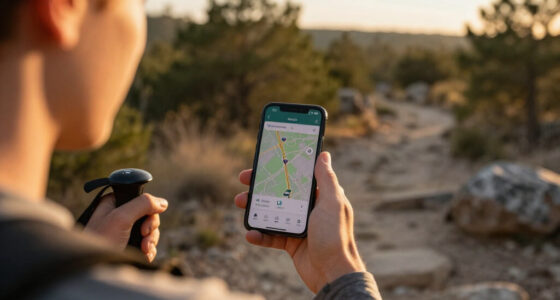
Planning a trip to Arches National Park requires more than just a smartphone signal, which often fails in the remote desert canyons. My top recommendation for most visitors is the National Geographic Trails Illustrated Map 211, offering the precise topographic detail needed to navigate trailheads safely. For those seeking a broader road trip context, the Lonely Planet Utah’s National Parks guide provides excellent logistical support for combining Arches with nearby Zion and Bryce Canyon. The primary tradeoff you will face is between granular hiking data and general travel logistics. A detailed map helps you find a specific arch, but a guidebook helps you find a hotel or a restaurant in Moab. Below, I break down nine essential resources to help you choose the right mix for your specific travel style.

Get emergency and outdoor gear delivered free with Prime
- Fast, free delivery on millions of items
- Prime Video, Amazon Music and more included
- Member-only deals all year
Key Takeaways
- Topographic maps like National Geographic’s Trails Illustrated are indispensable because GPS signals frequently drop in Arches‘ deep sandstone canyons.
- Guidebooks vary significantly in scope; some focus exclusively on trail details while others cover the entire Utah National Parks circuit.
- Beginners benefit more from ‘Easy Day Hikes’ guides that filter out strenuous, exposed terrain not suitable for first-time visitors.
- RV travelers need specialized road trip guides that account for vehicle length restrictions on park roads and campsite availability.
- Buying a single park-specific guide often lacks context for the surrounding area, making regional guides better value for multi-park trips.
| Arches National Park Map (National Geographic Trails Illustrated Map, 211) |  | Best for On-Trail Orientation | Map series: National Geographic Trails Illustrated | Map number: 211 | Location: Arches National Park | VIEW LATEST PRICE | See Our Full Breakdown |
| Lonely Planet Utah’s National Parks: Zion, Bryce Canyon, Arches, Canyonlands & Capitol Reef |  | Best for Multi-Park Trip Planning | Publisher: Lonely Planet | Series: National Parks Guide | Regions covered: Zion, Bryce Canyon, Arches, Canyonlands, and Capitol Reef | VIEW LATEST PRICE | See Our Full Breakdown |
| Utah National Parks Map Pack Bundle – National Geographic Trails Illustrated Map |  | Best for Multi-Park Map Coverage | Map series: National Geographic Trails Illustrated | Coverage: Multiple Utah national parks | Map content: Topographic details, roadways, and points of interest | VIEW LATEST PRICE | See Our Full Breakdown |
| Fodor’s InFocus Arches & Canyonlands National Parks: With Moab |  | Best for an Arches-and-Moab Base | Publisher: Fodor’s | Series: InFocus | Format: Travel guide | VIEW LATEST PRICE | See Our Full Breakdown |
| Fodor’s Utah: A Full-Color Travel Guide to Zion, Bryce Canyon, Arches, Capitol Reef, and Canyonlands National Parks |  | Best for a Statewide Utah Parks Tour | Publisher: Fodor’s | Format: Full-color travel guide | Destination: Utah | VIEW LATEST PRICE | See Our Full Breakdown |
| Moon Arches & Canyonlands National Parks: Hiking, Biking, Scenic Drives |  | Best for Multi-Activity Planning | ASIN: 1640494693 | Format: Travel Guide | Primary destination: Arches National Park | VIEW LATEST PRICE | See Our Full Breakdown |
| Best Easy Day Hikes Canyonlands and Arches National Parks |  | Best for Easier Day Hikes | ASIN: 1493067303 | Series: Best Easy Day Hikes | Format: Hiking guide | VIEW LATEST PRICE | See Our Full Breakdown |
| Grand Circle National Parks RV and Road Trip Guide |  | Best for a Multi-Park RV Road Trip | ASIN: B0FB571FBM | Format: RV and road trip guide | Regions: Utah and Arizona | VIEW LATEST PRICE | See Our Full Breakdown |
| Moon Arches & Canyonlands National Parks (Travel Guide) |  | Best for Park-Specific Itinerary Planning | ASIN: 1631215043 | Format: Travel Guide | Publisher: Moon Travel Guides | VIEW LATEST PRICE | See Our Full Breakdown |
| Arches National Park travel gear | Format | ASIN |
|---|---|---|
| Arches National Park Map | Printed map | 1566953278 |
| Lonely Planet Utah’s National | Printed guidebook | — |
| Utah National Parks Map Pack B | Printed map bundle | 1597755974 |
| Fodor’s InFocus Arches & Canyo | Travel guide | 1640978704 |
| Fodor’s Utah: A Full-Color Tra | Full-color travel guide | 1640975705 |
| Moon Arches & Canyonlands Nati | Travel Guide | 1640494693 |
| Best Easy Day Hikes Canyonland | Hiking guide | 1493067303 |
| Grand Circle National Parks RV | RV and road trip guide | B0FB571FBM |
| Moon Arches & Canyonlands Nati | Travel Guide | 1631215043 |
More Details on Our Top Picks
Arches National Park Map (National Geographic Trails Illustrated Map, 211)
For travelers who want a map focused on Arches itself, this Trails Illustrated sheet prioritizes topographic detail and trail information over broad trip planning. That makes it a more direct field companion than Lonely Planet Utah’s National Parks, which covers five parks but also asks you to carry a guidebook with wider-ranging advice. The park-specific focus can help hikers relate trails to the surrounding terrain instead of relying only on written directions. Its limit is the same as its strength: it covers one park, not a Utah-wide itinerary. The printed format can also be vulnerable to water, so it suits careful map handling better than wet-weather use. I’d choose it for Arches trail orientation, not as a complete planning resource.
Pros:- Detailed topographic information supports terrain-aware route planning.
- Focused specifically on Arches National Park trails.
- Made by National Geographic’s Trails Illustrated map series.
Cons:- Paper construction can be damaged by water.
- Coverage is limited to Arches rather than multiple Utah parks.
Best for: Hikers who want a dedicated Arches map with topographic context for planning and following park trails.
Not ideal for: Visitors planning a multi-park Utah trip or anyone who needs a water-resistant or digital navigation option.
- Map series:National Geographic Trails Illustrated
- Map number:211
- Location:Arches National Park
- Map focus:Park trails and topographic information
- Format:Printed map
- ASIN:1566953278
Our verdict“Choose this map for Arches-focused trail orientation, but pair it with broader trip-planning material if your itinerary spans several parks.”
Lonely Planet Utah’s National Parks: Zion, Bryce Canyon, Arches, Canyonlands & Capitol Reef
This guide suits travelers who need itineraries and practical advice across Utah, rather than a map devoted to a single park. Its coverage of Zion, Bryce Canyon, Arches, Canyonlands, and Capitol Reef makes it broader than Arches National Park Map (Trails Illustrated 211), while its hiking information gives trip planning more context than a map pack alone. That breadth is useful when deciding how to divide time among parks, but it also means Arches is one part of a larger guide, not the sole focus. Printed advice can become dated, so I’d check current park conditions and access information separately. The book may also be cumbersome to carry on long hikes; it makes more sense at camp, in the car, or during itinerary planning.
Pros:- Covers five major Utah national parks in one guide.
- Includes hiking and itinerary information for trip planning.
- Useful beyond Arches for a multi-park route.
Cons:- Printed information can become outdated.
- A guidebook may be heavy to carry on hikes.
- Arches-specific detail is shared with four other park destinations.
Best for: Road-trippers building an itinerary across Utah’s five named national parks who want hiking ideas and practical guidance in one book.
Not ideal for: Day hikers seeking a lightweight trail-side reference or travelers who need current, park-specific access updates.
- Publisher:Lonely Planet
- Series:National Parks Guide
- Regions covered:Zion, Bryce Canyon, Arches, Canyonlands, and Capitol Reef
- Content:Itineraries, hiking trails, and practical travel tips
- Format:Printed guidebook
- ISBN:1838699856
Our verdict“Pick this for planning a multi-park Utah trip, and use a dedicated Arches map for more focused field navigation.”
Utah National Parks Map Pack Bundle – National Geographic Trails Illustrated Map
When a Utah itinerary includes several parks, this bundle offers a different kind of coverage from the single-sheet Trails Illustrated Arches map: multiple park maps with topographic detail, roads, and points of interest. The set is aimed at travelers who want paper references they can consult across a wider route, rather than one guidebook for itineraries and general advice. Its illustrated, portable paper format is suitable for field reference, though it lacks digital or interactive features. Compared with Lonely Planet Utah’s National Parks, the bundle is more map-centered and less focused on written hiking and trip-planning guidance. The provided product details don’t specify exactly which maps or parks are included, so I’d verify the bundle’s contents before relying on it for a particular destination.
Pros:- Designed to cover multiple Utah national parks.
- Includes topographic detail, roadways, and points of interest.
- Portable printed format supports reference away from a screen.
- National Geographic illustrations provide a map-focused alternative to guidebooks.
Cons:- No digital or interactive navigation features.
- Exact map and park inclusions are not specified in the supplied product details.
- Paper maps can be less convenient than digital tools for quick route changes.
Best for: Road-trippers and hikers visiting several Utah parks who prefer printed topographic maps for route and points-of-interest reference.
Not ideal for: Visitors who need turn-by-turn digital navigation, written itineraries, or confirmed coverage of a specific park without checking the bundle contents.
- Map series:National Geographic Trails Illustrated
- Coverage:Multiple Utah national parks
- Map content:Topographic details, roadways, and points of interest
- Format:Printed map bundle
- Illustration:National Geographic map illustrations
- Digital features:No digital or interactive version specified
- ASIN:1597755974
Our verdict“Choose this bundle for printed map coverage across a Utah parks trip, after confirming the included parks match your route.”
Fodor’s InFocus Arches & Canyonlands National Parks: With Moab
This guide has the tightest geographic fit for travelers using Moab as a base for Arches and Canyonlands. Unlike the five-park coverage in Fodor’s Utah or Lonely Planet Utah’s National Parks, it keeps its scope to two nearby parks and the surrounding town. That narrower focus can make it a more relevant companion for a short Moab-centered visit, while the full-color format supports quick browsing. The tradeoff is limited reach: it won’t serve travelers planning a broader loop through Zion, Bryce Canyon, or Capitol Reef as well. The supplied details don’t specify trail depth, itineraries, or update information, so I would treat it as a destination guide rather than assume it replaces current park maps or official conditions.
Pros:- Covers Arches, Canyonlands, and the surrounding Moab area.
- Narrow geographic scope suits a Moab-based visit.
- Full-color format makes the guide easy to browse.
Cons:- Does not cover Utah’s other major national parks.
- Supplied details don’t confirm the depth of trail or itinerary information.
- A travel guide is not a substitute for current park conditions or dedicated navigation maps.
Best for: Visitors staying in or near Moab who plan to visit both Arches and Canyonlands and want one focused color guide.
Not ideal for: Travelers building a statewide Utah parks itinerary or hikers who need confirmed detailed trail-navigation information.
- Publisher:Fodor’s
- Series:InFocus
- Format:Travel guide
- Color:Full color
- Coverage:Arches and Canyonlands National Parks
- Additional area:Moab
- ASIN:1640978704
Our verdict“Pick this for a focused Moab trip covering Arches and Canyonlands, not for a statewide parks tour.”
Fodor’s Utah: A Full-Color Travel Guide to Zion, Bryce Canyon, Arches, Capitol Reef, and Canyonlands National Parks
For a trip that connects Utah’s major parks, this guide’s five-park coverage is a better match than the Moab-centered Fodor’s InFocus Arches & Canyonlands. Its full-color format gives it broad trip-planning appeal, while its inclusion of Arches alongside Zion, Bryce Canyon, Capitol Reef, and Canyonlands makes it relevant to a longer statewide route. That range comes with less geographic focus: travelers spending most of their time around Moab may prefer the InFocus guide’s tighter coverage, and hikers seeking trail-level orientation should look to a dedicated map such as Trails Illustrated 211. The supplied details don’t describe specific itineraries or trail content, so I’d choose it for broad destination coverage rather than assume it offers detailed on-trail guidance.
Pros:- Covers five major Utah national parks in one guide.
- Full-color format supports browsing and trip planning.
- Includes Arches in a broader statewide destination overview.
Cons:- Broader coverage may provide less focus on Arches and the Moab area.
- Supplied details don’t specify trail or itinerary depth.
- A travel guide does not replace a dedicated topographic map for field navigation.
Best for: Travelers planning a Utah road trip that includes Arches plus several of the state’s other major national parks.
Not ideal for: Visitors focused only on Arches and Moab, or hikers who need detailed trail navigation rather than a broad travel guide.
- Publisher:Fodor’s
- Format:Full-color travel guide
- Destination:Utah
- Featured parks:Zion, Bryce Canyon, Arches, Capitol Reef, and Canyonlands
- Coverage type:Multi-park travel guide
- ASIN:1640975705
Our verdict“Choose this for a multi-park Utah road trip; for a Moab-focused stay, Fodor’s InFocus is the more tightly targeted companion.”
Moon Arches & Canyonlands National Parks: Hiking, Biking, Scenic Drives
I’d pick this guide when a visit to Arches is part of a broader outdoor itinerary, not just a list of hikes. Its coverage of hiking, biking, and scenic drives gives it a wider activity range than Best Easy Day Hikes Canyonlands and Arches National Parks, which is aimed at easier walks. The focus on Arches and Canyonlands also keeps the scope more manageable than the Grand Circle National Parks RV and Road Trip Guide, which spans several states and parks. That balance suits travelers splitting time between the two Utah parks and planning different kinds of outings. The tradeoff is that the supplied information does not identify specific trail details or how recently the guide was updated, so I wouldn’t rely on it alone for current conditions or route decisions.
Pros:- Covers hiking, biking, and scenic drives in one guide.
- Focuses on Arches and Canyonlands rather than a large regional circuit.
- Supports trip planning across multiple activity types.
Cons:- The supplied product details do not name specific trails or routes.
- A guidebook is not a substitute for a dedicated navigation map.
- The supplied information does not establish how current its guidance is.
Best for: Visitors planning a mixed Arches and Canyonlands itinerary with hikes, bike routes, and scenic drives.
Not ideal for: Travelers who need a focused guide to easy walks only or a map for on-trail navigation.
- ASIN:1640494693
- Format:Travel Guide
- Primary destination:Arches National Park
- Additional destination:Canyonlands National Park
- Activities covered:Hiking, biking, scenic drives
- Trip-planning focus:Exploring two Utah national parks
Our verdict“Choose this guide if your Arches visit includes more than hiking and you also plan to explore Canyonlands.”
Best Easy Day Hikes Canyonlands and Arches National Parks
For visitors who want walking routes without centering their trip on strenuous hikes, this is the most clearly targeted choice in the group. The easy day hike focus makes it a more specific fit than Moon Arches & Canyonlands National Parks: Hiking, Biking, Scenic Drives, whose coverage also includes biking and driving. It also avoids the broad, multi-park scope of the Grand Circle National Parks RV and Road Trip Guide. That narrower purpose can help a beginner or family choose a guide aligned with shorter outings, but the supplied description does not list trail names, distances, elevation, or accessibility details. I’d treat it as a hiking-focused planning companion, not a complete Arches trip guide or a replacement for current park information and maps.
Pros:- Clearly focuses on easy day hikes.
- Covers both Arches and Canyonlands.
- Its narrow hiking scope is straightforward for visitors prioritizing shorter walks.
Cons:- The supplied details do not identify trails or provide distances and difficulty specifics.
- Does not cover biking or scenic drives in the supplied description.
- Limited scope makes it less useful as a complete trip-planning guide.
Best for: First-time visitors and families seeking a guide focused on easier day hikes in Arches and Canyonlands.
Not ideal for: Travelers planning challenging routes, biking, scenic drives, or a full multi-activity itinerary.
- ASIN:1493067303
- Series:Best Easy Day Hikes
- Format:Hiking guide
- Primary destination:Arches National Park
- Additional destination:Canyonlands National Park
- Hike focus:Easy day hikes
Our verdict“Pick this guide if easier walks are your priority and you don’t need broad activity or regional coverage.”
Grand Circle National Parks RV and Road Trip Guide
This is the broadest-planning option here: it connects Arches with a larger Utah and Arizona route covering seven named parks. That makes it a stronger match than Moon Arches & Canyonlands National Parks: Hiking, Biking, Scenic Drives for travelers moving between several destinations by RV or car, while the Moon guide keeps attention on Arches and Canyonlands. Its inclusion of RV travel and hiking is useful when campsite logistics and outdoor stops share the itinerary. The tradeoff is focus: with Zion, Bryce Canyon, Capitol Reef, Mesa Verde, and the Grand Canyon also in scope, it may offer less concentrated Arches guidance than Moon Arches & Canyonlands National Parks (Travel Guide). The supplied details don’t specify route-planning features or trail particulars, so I’d pair it with park-specific information.
Pros:- Covers a seven-park regional itinerary.
- Combines RV and road-trip planning with hiking coverage.
- Includes destinations in both Utah and Arizona.
Cons:- Its wide geographic scope may mean less focus on Arches-specific details.
- The supplied description does not specify trail names, routes, or RV facilities.
- Travelers visiting only Arches may find much of its regional coverage unnecessary.
Best for: RV travelers or road-trippers linking Arches with other national parks across Utah and Arizona.
Not ideal for: Visitors spending most of their trip in Arches who want detailed, park-specific hiking guidance.
- ASIN:B0FB571FBM
- Format:RV and road trip guide
- Regions:Utah and Arizona
- Destinations:Zion, Bryce Canyon, Capitol Reef, Arches, Canyonlands, Mesa Verde, and the Grand Canyon
- Arches coverage:Included
- Activities covered:RV travel, road trips, hiking
Our verdict“Choose this guide for an RV or road trip linking Arches with several other Utah and Arizona parks.”
Moon Arches & Canyonlands National Parks (Travel Guide)
I’d favor this edition when Arches and Canyonlands are the trip, rather than stops on a much larger circuit. Its stated coverage of detailed itineraries, hiking trails, and practical visitor tips gives it a more direct planning role than Best Easy Day Hikes Canyonlands and Arches National Parks, which focuses on easy hikes. Compared with the Grand Circle National Parks RV and Road Trip Guide, it trades regional breadth for a closer focus on these two parks. That makes it a plausible fit for visitors organizing days around trails and park visits. The downside is the same narrow scope that creates that focus: it does not cover the surrounding national-park circuit, and the supplied data does not confirm how recently its guidance was updated. I’d check current park conditions separately.
Pros:- Dedicated to Arches and Canyonlands.
- Includes itinerary and hiking information.
- Offers practical visitor tips according to the supplied description.
Cons:- Does not cover the wider regional route found in the Grand Circle guide.
- The supplied data does not establish how recently the information was updated.
- May offer more coverage than needed for visitors seeking only easy day hikes.
Best for: Travelers building an itinerary around Arches and Canyonlands who want hiking and practical trip-planning guidance.
Not ideal for: Road-trippers seeking one guide for a multi-park Utah and Arizona route, or visitors who only need easy-hike suggestions.
- ASIN:1631215043
- Format:Travel Guide
- Publisher:Moon Travel Guides
- Primary destination:Arches National Park
- Additional destination:Canyonlands National Park
- Planning features:Detailed itineraries and practical visitor tips
- Hiking coverage:Hiking trails
Our verdict“Choose this guide if you want itinerary and hiking coverage centered on Arches and Canyonlands rather than a wider road trip.”
How We Picked
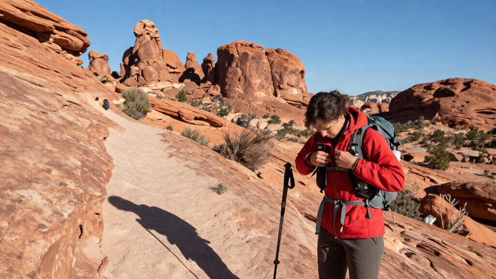
I evaluated these resources based on their utility in the field, focusing on accuracy, durability, and the clarity of information. For maps, I prioritized topographic detail and waterproof capabilities, as paper maps must withstand wind and occasional rain. For guidebooks, I assessed the balance between hiking specifics and general travel logistics, such as dining and lodging recommendations in Moab. I also considered the target audience, distinguishing between resources for casual sightseers and serious hikers. The ranking reflects a hierarchy of necessity: a reliable map is the primary safety tool, followed by a guidebook that enhances the experience with context and recommendations.
Factors to Consider When Choosing Best Arches National Park Travel Gear
Choosing the right travel gear for Arches depends largely on how you plan to spend your time in the park. Are you driving the scenic route, or are you lacing up boots for a four-mile trek? The following factors will help you decide which combination of maps and books belongs in your pack.Map Detail vs. Guidebook Context
You must decide whether you need a tool for navigation or a tool for planning. A topographic map is a navigation tool; it shows elevation, trail gradients, and exact locations of formations. It does not tell you which trail is less crowded on a Saturday morning. Conversely, a guidebook provides that context but may lack the precise grid coordinates needed for off-trail orientation. For most visitors, carrying both is ideal, but if you must choose one, prioritize the map if you plan to hike beyond the main viewpoints.
Scope: Single Park vs. Regional Coverage
Many travelers combine Arches with Canyonlands, Zion, or Capitol Reef. Buying a guidebook dedicated solely to Arches might leave you without information for the other stops on your itinerary. I recommend looking at your overall trip plan. If you are spending only one day in Arches, a regional guide covering all Utah national parks offers better value. However, if you are staying in Moab for a week, a park-specific guide provides deeper insights into hidden gems and local history that regional books skim over.
Physical Durability in Desert Conditions
The environment in Arches is harsh on paper products. Wind can tear pages, and sweat or accidental spills can ruin ink. Look for maps printed on synthetic, waterproof material rather than standard paper. Guidebooks are rarely waterproof, so consider keeping yours in a ziplock bag or using it primarily for pre-trip planning. If you plan to carry a guidebook on the trail, choose a paperback with a flexible cover that can withstand being stuffed into a backpack side pocket without cracking the spine.
Hiking Difficulty Alignment
Not all gear is suited for all fitness levels. Some guidebooks assume a moderate to high fitness level, describing trails with significant elevation gain or exposed rock scrambling. If you are traveling with children or prefer flat, easy walks, seek out resources specifically labeled for easy day hikes or family-friendly activities. These guides filter out the strenuous routes, saving you from choosing a trail that is physically beyond your group’s capability. Misjudging difficulty is a common mistake that leads to exhaustion and disappointment.
Vehicle Type and Lodging Needs
Your mode of transport dictates your gear needs. RV travelers face specific constraints regarding parking, road width, and campsite hookups that standard car travelers do not. A general travel guide may not mention that certain pull-offs are inaccessible to vehicles over 25 feet. If you are in an RV, invest in a road trip guide specifically for RVs. These books provide critical data on dump stations, low-clearance bridges, and oversized vehicle restrictions that are vital for a stress-free trip.
Frequently Asked Questions
Do I really need a paper map if I have a downloaded offline map on my phone?
Yes, I strongly recommend carrying a paper map as a backup. Electronic devices can fail due to battery drain, extreme heat, or accidental drops. Furthermore, phone screens can become unreadable in direct sunlight, which is common in Arches. A paper map does not require power, is easier to read at a glance, and allows you to see the broader topographic context without zooming in and out. Relying solely on a phone is a risk not worth taking in remote areas.Is it better to buy a guidebook for just Arches or one for all Utah national parks?
This depends on your itinerary length. If you are visiting only Arches for a weekend, a specialized guide offers deeper historical and ecological details. However, most tourists combine Arches with Canyonlands or Zion. In that case, a regional guide is more cost-effective and prevents you from carrying multiple heavy books. Regional guides also provide better advice on driving routes between parks, which is valuable for time management.Which guide is best for families with young children?
Look for guides that explicitly label trails by difficulty and mention kid-friendly features like short distances and minimal elevation gain. Guides titled ‘Easy Day Hikes’ or those with specific family sections are superior to general hiking guides, which often overlook the needs of small children. These resources help you avoid trails with steep drop-offs or loose gravel, ensuring a safe and enjoyable experience for younger members of your group.Free brochures are excellent for an overview but insufficient for serious hiking. They typically show only the main roads and the most popular viewpoints. They lack the trail details, elevation contours, and distance markers found in commercial maps. If you plan to venture beyond the Delicate Arch viewpoint or the Windows section, you will need a detailed topographic map to navigate safely and accurately.
Are digital guidebooks a viable alternative to print?
Digital guidebooks are convenient for pre-trip planning but have limitations in the field. Reading long text on a small screen is tiring, and you cannot easily view a map and text simultaneously. Additionally, if your device dies, you lose access. I suggest using a digital version for hotel room planning and carrying a physical map and a short printed itinerary for the actual trail days. This hybrid approach balances convenience with reliability.Conclusion
Choosing the right gear for Arches National Park comes down to matching the resource to your specific travel style. For the Best Overall experience, the National Geographic Trails Illustrated Map 211 is the non-negotiable foundation for any visitor. If you are a Beginner or traveling with family, the Best Easy Day Hikes Canyonlands and Arches National Parks guide will help you select safe, rewarding trails without overwhelming you with technical details. For Road Trippers covering multiple parks, the Lonely Planet Utah’s National Parks guide offers the best balance of logistics and inspiration. RV Travelers should prioritize the Grand Circle National Parks RV and Road Trip Guide to avoid vehicle-related headaches. Finally, for the Deep Diver who wants comprehensive historical and ecological context, the Moon Arches & Canyonlands National Parks guide provides the depth needed for a thorough exploration. Pair a reliable map with one well-chosen guidebook, and you will be prepared for the red rock wonders ahead.
Evergreen bestsellers Picks

Shark IQ Robot Self-Empty XL Robot Vacuum with Home Mapping, Self-Cleaning Brushroll, and Wi-Fi, Black

Ninja DZ801 DualZone 6-in-1 Air Fryer, 8 Qt, Grey

Dyson V15 Detect Cordless Vacuum
As an affiliate, we earn on qualifying purchases.