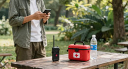
To avoid getting lost, use a mix of tech and traditional skills. Keep your smartphone’s GPS charged, download offline maps, and know how to troubleshoot. Carry a paper map, understand how to read it, and recognize natural landmarks to confirm your location. Plan your route, track your progress, and stay calm if you encounter challenges. Combining these strategies helps you stay safe. If you explore further, you’ll discover even more ways to stay found in any environment.
Key Takeaways
- Use GPS apps with downloaded offline maps and keep devices charged; carry portable batteries for backup.
- Cross-verify digital location data with natural landmarks and terrain features for redundancy.
- Carry and know how to use a compass and traditional navigation techniques as backup.
- Regularly check your route, identify landmarks, and track progress against your plan.
- Interpret map symbols and terrain changes to confirm your position and avoid disorientation.

Handheld GPS for Hiking, Rugged and Waterproof Handheld GPS Navigator, 3.2" Sunlight Readable Screen, Compact Satellite Handheld GPS with USA Topo Map, Multi-GNSS Support, Extra Battery Life
Compact and lightweight GPS handheld navigator boasts an anti-slip design offering a bright 3.2" screen that is sunlight…
As an affiliate, we earn on qualifying purchases.
As an affiliate, we earn on qualifying purchases.
Harnessing Smartphone GPS and Navigation Apps

Smartphone GPS and navigation apps have become essential tools for staying found in unfamiliar or remote areas. To make the most of these tools, focus on effective wayfinding strategies, such as setting waypoints, checking your route regularly, and understanding the app’s features. Always keep your device charged and carry a portable battery pack, so you’re ready if GPS troubleshooting becomes necessary. Familiarize yourself with offline maps and download relevant data beforehand, reducing reliance on cell signals. Practice basic troubleshooting steps like restarting your phone or resetting GPS settings if your app isn’t updating your location. Additionally, some navigation apps offer navigation explainers that help users understand how their devices determine and display their position. Utilizing simple systems and familiar routines can also enhance your confidence in navigation. Being aware of redundant navigation methods and backup plans can further safeguard against technology failures. These proactive measures help ensure your navigation remains accurate, giving you confidence to explore new places without fear of losing your way.

OsmAnd — Offline Travel Maps & Navigation
Navigation
As an affiliate, we earn on qualifying purchases.
As an affiliate, we earn on qualifying purchases.
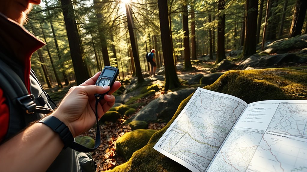
The Art of Reading and Using Paper Maps
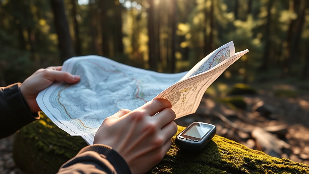
Choosing the right map sets the foundation for successful navigation, so you need to pick one that suits your journey. Once you have it, understanding map symbols helps you quickly identify landmarks and routes. With practice, you’ll navigate confidently and rely less on digital devices. Incorporating visual cues into your map reading can further enhance your ability to find your way accurately. Additionally, practicing with different types of maps, such as topographic or street maps, can broaden your navigation skills and improve your familiarity with free floating environments. Exploring various map formats can also help you adapt to diverse navigation challenges and become more versatile in unfamiliar settings. Mastering these skills can also help you adapt to European cloud innovation principles, where flexible and reliable solutions are essential for effective operations. Developing a keen understanding of contrast ratio and other visual elements can improve your interpretation of map details under different lighting conditions.
Choosing the Right Map
Selecting the right paper map is essential for successful navigation, especially when technology isn’t available. You need a map that’s easy to interpret and matches your journey’s scale. Focus on map orientation—make sure it aligns with your actual surroundings—and ensure you understand the scale comprehension to estimate distances accurately. A well-chosen map features clear labels and a relevant coverage area.
| Feature | Importance |
|---|---|
| Map Orientation | Ensures you match the map’s direction with your environment. |
| Scale Comprehension | Helps you judge distances and plan routes effectively. |
| Coverage Area | Matches your intended trail or region. |
| Readability | Large, clear labels make navigation easier. |
Pick a map that’s updated, easy to read, and suited for your specific adventure.
Reading Map Symbols
Understanding map symbols is key to interpreting what you see on a paper map. The chart legend explains the symbol meanings, turning abstract marks into helpful information. When you look at a map, picture these symbols:
- A tiny blue triangle representing a campsite.
- Dotted lines indicating hiking trails.
- Green patches showing forested areas.
These symbols help you navigate without confusion. Recognizing the chart legend allows you to decode features like water bodies, roads, and landmarks quickly. Keep the legend handy and familiarize yourself with common symbols before heading out. This way, you’ll understand the terrain at a glance and make better decisions as you explore. Mastering map symbols transforms a simple paper map into a powerful tool for confident navigation.
Navigating With Confidence
To navigate with confidence, you need to become proficient in reading and interpreting your paper map quickly and accurately. This involves mastering using compass skills to orient yourself correctly and understanding how to read topographical features. Recognize contour lines to gauge elevation changes and identify landmarks like ridges, valleys, or water bodies. Cross-reference these details with your surroundings to confirm your position. Practice aligning your map with actual terrain, ensuring north on the map matches your compass reading. By honing these skills, you’ll develop a clear mental picture of your environment, making navigation more intuitive. Confident map reading reduces reliance on technology and helps you stay found even in challenging conditions. The key is consistent practice and staying aware of your environment’s natural cues.

Land Nav Kit with Lensatic Compass, Protractor, Pace Counter & Map Markers
FIELD READY – Crush your next land navigation course with The Land Nav Kit designed specifically for the…
As an affiliate, we earn on qualifying purchases.
As an affiliate, we earn on qualifying purchases.
Recognizing Natural Landmarks and Terrain Features
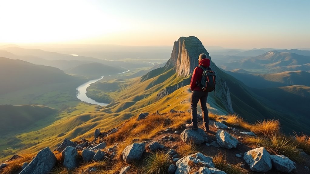
You can stay oriented by spotting distinctive natural landmarks like hills, rivers, or unique trees. Pay attention to terrain changes such as slopes, valleys, or ridges that signal your position. Using these natural features helps you navigate confidently without relying solely on maps. Additionally, cultivating an awareness of your inner guidance can enhance your ability to recognize subtle environmental cues and maintain your sense of direction. Developing visual and auditory cues awareness can further support your navigation skills, especially in unfamiliar environments. Recognizing terrain features like these is a fundamental outdoor skill that can greatly improve your confidence in finding your way. Understanding how landscape patterns form and change can also provide valuable context for navigation. Being familiar with different electric dirt bike models and their capabilities can help you better understand the terrain and limitations when exploring unfamiliar areas.
Spot Distinctive Landmarks
Have you ever looked at a landscape and immediately recognized a mountain peak or a distinctive river bend? That’s the power of visual landmark selection. To spot distinctive landmarks, focus on features that stand out from their surroundings. Consider:
- A sharply pointed mountain that rises above the treeline
- A wide, looping river carving a unique bend in the terrain
- An isolated rock formation or cliff face with clear outlines
- Incorporating artistic elements into your recognition process can help you better identify landmarks that complement natural features. Developing an understanding of terrain features can further enhance your navigation skills. Recognizing the importance of natural landmarks and terrain features helps you distinguish reliable reference points. Use landmark relevance assessment to determine which features are reliable references. Look for landmarks that are easily identifiable from multiple angles and unlikely to change over time. By honing these skills, you’ll improve your ability to navigate confidently, even in unfamiliar terrain. Recognizing these natural markers, along with Vetted – 1st Home Theatre Projector, keeps you oriented and helps avoid getting lost.
Read Terrain Changes
Recognizing natural landmarks and terrain features requires paying close attention to how the landscape changes as you move. Observe the terrain evolution—note if the ground becomes steeper, flatter, or more rugged. Changes in vegetation, such as dense trees giving way to open grasslands, also signal shifts in terrain. Weather impact can alter how features appear; for example, recent rain might make rocky areas slick or create new water crossings. Keep an eye on subtle differences, like soil color or rock formations, that remain consistent despite weather variations. By actively noticing these terrain changes, you can better understand your position and avoid disorientation. Being aware of terrain evolution helps you anticipate your route, making navigation more reliable whether the terrain evolves naturally or weather impacts visibility. Recognizing landscape features such as ridges, valleys, and water bodies further enhances situational awareness and navigation accuracy. Paying attention to these natural landmarks can also help reinforce your understanding of the landscape, especially when technology fails or is unavailable. Additionally, awareness of the Sun’s position can assist in orienting yourself when other cues are limited. Moreover, understanding net worth figures of local figures or celebrities can sometimes offer insights into the area’s economic landscape.
Use Natural Landmarks
How can identifying natural landmarks improve your navigation? Landmark identification boosts your natural navigation skills by giving you clear reference points. Recognizing terrain features helps you stay oriented and avoid getting lost. Picture these common natural landmarks: 1. A towering cliff face standing out against the skyline, guiding you along a ridge. 2. A winding river cutting through the landscape, marking your path or destination. 3. A distinctive tree cluster or rock formation that’s easy to spot from afar. Incorporating topographical awareness into your navigation techniques enhances your ability to interpret landscape features and maintain orientation. Additionally, understanding terrain features can help you adapt your route based on natural obstacles and landforms, which is essential for biodiversity conservation and maintaining a safe route in various environments. Developing your skills in natural landmark recognition allows for more reliable navigation even when technology fails or is unavailable. Mastering visual cues from the environment can further strengthen your capacity to navigate confidently in unfamiliar terrain.

United States, Northeast Map (National Geographic Adventure Map, 3127)
As an affiliate, we earn on qualifying purchases.
As an affiliate, we earn on qualifying purchases.
Planning Your Route and Keeping Track of Your Progress
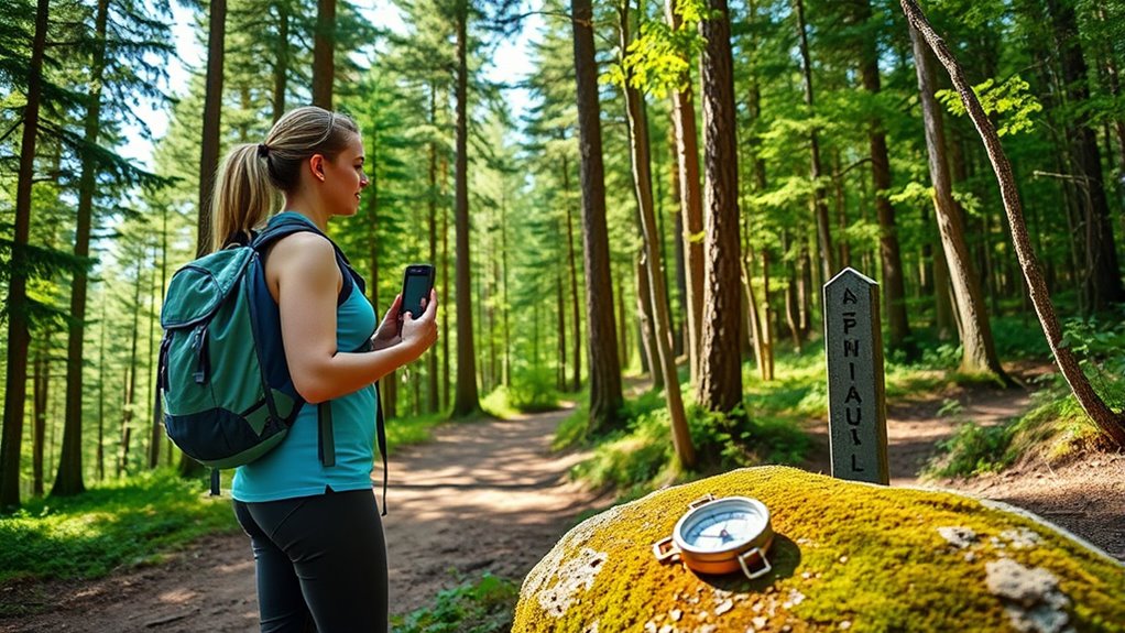
Planning your route carefully is essential to staying found, especially in unfamiliar terrain. Good route planning helps you avoid dead ends and makes progress tracking easier. Before setting out, study maps and identify landmarks, trails, and compass points. Keep a detailed note of your intended path. During your hike, regularly check your position against your plan to track progress and confirm you’re on course. Use the table below to visualize your route and monitor your progress:
| Checkpoint | Distance Traveled | Notes | Next Step | Estimated Time |
|---|---|---|---|---|
| Trailhead | 0 miles | Starting point | Follow marked trail | 10 mins |
| Creek crossing | 2 miles | Water level high | Cross safely | 30 mins |
| Ridge summit | 4 miles | Clear view | Descend to forest | 1 hour |
| Campsite | 6 miles | Rest spot | Continue south | 1.5 hours |
| End point | 8 miles | Destination reached | Return route | 2 hours |
This approach keeps you aware of your progress and helps prevent getting lost.
Tips for Staying Calm and Making Good Decisions
Staying calm in the wilderness is essential for making sound decisions, especially when conditions become challenging. When your mind stays clear, you’re better equipped to assess situations and avoid panic. To maintain mental preparedness and manage stress, focus on these key steps:
- Take slow, deep breaths to steady your nerves and lower adrenaline.
- Visualize your options clearly, weighing the pros and cons before acting.
- Remind yourself that staying calm preserves energy and sharpens judgment.
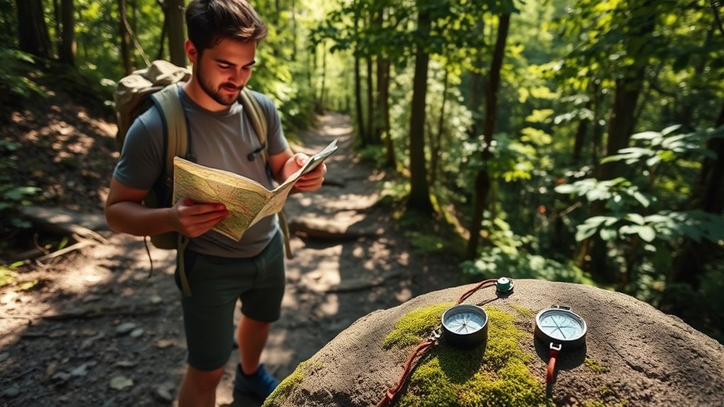
Combining Technology and Traditional Skills for Best Results
In high-pressure situations, combining the latest technology with traditional survival skills can greatly improve your chances of staying safe and found. Use your GPS device to pinpoint your location, but don’t rely solely on it. Incorporate compass navigation to maintain orientation if electronic tools fail or batteries run out. Traditional skills like trail marking become invaluable—mark trees or rocks to create a visual trail for yourself or others. This helps you retrace your steps or guide rescuers. Keep a mental map, and combine it with digital maps to cross-check your position. Blending these methods ensures redundancy, reducing the risk of getting more lost. Mastering both tech and old tricks provides a balanced approach that adapts to changing conditions and maximizes your chances of rescue.
Frequently Asked Questions
How Can I Ensure My GPS Device Works Without Cellular Service?
To guarantee your GPS works without cellular service, you should download offline maps beforehand for areas you’ll visit. Always carry a device with satellite backup capability, like a handheld GPS unit, since it doesn’t rely on cell signals. Make sure your device is fully charged, and consider carrying extra batteries. These steps help you stay navigated and safe, even when cellular service drops out.
What Are the Best Natural Landmarks for Navigation in Dense Forests?
Imagine the forest as a giant puzzle, with natural landmarks as your guiding pieces. Tall, distinctive trees like oaks or pines act as signposts, while streams and rocky outcrops serve as natural breadcrumbs. Use these landmarks for forest navigation, recognizing their shapes and positions to keep your bearings. Trust in these permanent features—they’re your compass when the woods whisper confusing secrets, guiding you safely back to familiar ground.
How Do I Read Topographical Maps Effectively?
To read topographical maps effectively, start by understanding map symbols—they indicate features like water, trails, and elevation changes. Focus on contour lines, which show the terrain’s shape; close lines mean steep slopes, while wide spaced lines suggest gentle slopes. Always check the map’s legend, and use a compass to align the map with your surroundings. Practice interpreting these symbols and lines to navigate terrain confidently and avoid getting lost.
What Emergency Signals Should I Use if I Get Lost?
If you get lost, use signaling devices like a whistle, mirror, or flashlight to attract attention. Make rescue procedures easier by creating visible signals, such as large ground symbols or fire fires in open areas. Stay calm, stay in one spot, and use your signaling devices frequently. Keep your phone charged if possible, and call emergency services when you see or hear them. Your goal is to make yourself as visible and obvious as possible.
How Can I Combine Old and New Navigation Skills Efficiently?
Combining old and new navigation skills is like blending a map and a GPS for perfect orientation. You should depend on your compass skills and trail markers to build a mental map, then verify with digital tools. Use your compass for quick, reliable navigation, especially when tech fails. Cross-check trail markers with GPS data to ensure you’re on track, making your navigation both accurate and adaptable in any situation.
Conclusion
So, whether you’re glued to your smartphone or studying old maps, remember that tech can fail and landmarks can mislead. Ironically, the best way to stay found might just be trusting your instincts and basic skills. When your gadgets die or you get hopelessly lost, you’ll be glad you know how to read a map or spot a familiar tree. After all, sometimes the simplest tricks are your best backup—until your battery finally gives out.