
To plan your escape using tech, start by exploring navigation apps that show your current location and suggest alternate routes. Practice using these apps regularly and familiarize yourself with offline maps in case internet access drops. Keep your device charged and stay updated on alerts about hazards or closures. By integrating these tools with safety drills, you’ll move confidently during emergencies. Keep going to discover more ways to stay prepared and make your evacuation smoother.
Key Takeaways
- Pre-plan multiple evacuation routes using navigation apps for quick decision-making during emergencies.
- Regularly practice drills with digital maps to become familiar with routes and app features.
- Keep devices charged and update navigation apps to ensure reliable, real-time route guidance.
- Use apps that offer offline maps and alerts for hazards, obstacles, or road closures.
- Combine technology with physical maps as backups to enhance preparedness and response confidence.

In today’s fast-changing world, technology plays a crucial role in enhancing emergency preparedness, especially when it comes to mapping evacuation routes. With the right tools, you can plan ahead, identify the safest paths, and respond quickly when disaster strikes. Navigation apps are a essential part of this process, offering real-time updates and easy-to-follow directions that can help you escape dangerous situations efficiently. These apps can be customized to show your location, highlight alternate routes, and even alert you about traffic or obstacles that could slow you down during an emergency. By familiarizing yourself with these tools before an incident occurs, you gain a significant advantage, reducing panic and confusion when seconds matter most. European cloud servers can support the secure storage and sharing of critical evacuation data, ensuring information remains protected during emergencies.
Using navigation apps effectively requires some preparation. You should explore different options, ensuring the app you choose provides offline maps or can operate without internet access if your connection drops during a crisis. It’s also smart to pre-plan multiple routes from your home, workplace, and other frequented locations. This way, you’re not relying solely on a single path but have backup routes that can adapt to changing conditions. During safety drills, practice using these apps to navigate quickly and confidently. Repeated drills help you become comfortable with digital directions, making the process second nature when an actual emergency occurs. Remember, technology is a supplement, not a replacement for traditional safety knowledge, so always stay aware of your surroundings and have physical maps or printed routes as a backup.
Pre-plan multiple routes and practice using navigation apps for quick, confident emergency responses.
Incorporating tech into your emergency plans also involves understanding how to interpret alerts and updates from navigation apps. Many apps provide notifications about hazards, road closures, or weather conditions that could impact your escape. Keeping your device charged and having portable power sources ensures you stay connected when it matters most. It’s essential to keep your apps updated so you benefit from the latest features and data. During safety drills, simulate real scenarios by following app-guided routes, experimenting with different options to see how they perform under stress. This practice boosts your confidence and ensures that when an actual emergency happens, you’re not fumbling with unfamiliar technology but instead responding swiftly and effectively.
Ultimately, the integration of navigation apps and regular safety drills creates a robust system for emergency preparedness. You’ll be better equipped to identify safe routes, adapt to unexpected obstacles, and move quickly to safety. Technology isn’t just about convenience; it can be life-saving. By proactively using these tools and practicing your response, you turn a potentially chaotic situation into a manageable one, giving you peace of mind and a higher chance of staying safe when disaster strikes.
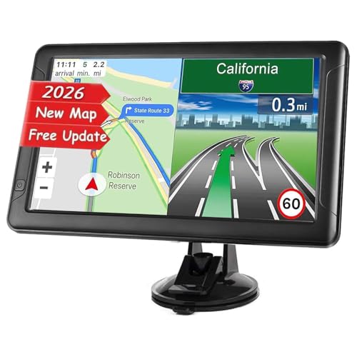
GPS Navigator for Car, Latest 2026 Map 9-inch Touch Screen 16GB GPS Navigation System,Truck GPS Navigation System,Voice Guidance and Speed Camera Warning GPS,Provides Lifetime Live Map Updates
【9 Inch 2.5D Touch Screen】The 9-inch large touch screen responds quickly without delay,safer, more beautiful and modern. The…
As an affiliate, we earn on qualifying purchases.
As an affiliate, we earn on qualifying purchases.
Frequently Asked Questions
How Often Should Evacuation Routes Be Updated With New Technology?
You should update your evacuation routes with new technology integration at least annually or whenever significant changes occur in your building or environment. Regular frequency updates guarantee the routes remain accurate and reliable during emergencies. Stay proactive by reviewing and refining your maps based on new data, technological advancements, or safety regulations. Consistent updates help you respond swiftly and effectively, minimizing risks during evacuations.
Can Residents Customize Evacuation Plans Based on Personal Needs?
Think of your evacuation plan as a tailored suit; you can customize it to fit your personal needs. Yes, residents can adapt their routes for accessibility considerations, ensuring safe passage for everyone. Leveraging tech allows you to personalize your plan, highlighting accessible paths and essential resources. By doing so, your escape becomes more efficient and inclusive, transforming a generic blueprint into a strategy that truly works for you and your unique circumstances.
What Privacy Concerns Are Associated With Using Mapping Apps for Emergencies?
Using mapping apps for emergencies raises privacy concerns about data privacy and location tracking. When you share your location, there’s a risk that your data could be accessed or misused by third parties. You should review app permissions and privacy policies, and enable features like location sharing only when necessary. Staying informed helps you protect your personal information while benefiting from essential emergency navigation tools.
How Accessible Are These Tech Tools for People With Disabilities?
Think of these tech tools as bridges over a river—helping everyone cross safely. They’re becoming more accessible thanks to assistive technology and strict accessibility standards, but gaps still exist. Some apps may not fully support screen readers or offer adjustable visuals for those with visual impairments. You can make a difference by choosing platforms that prioritize inclusive design, ensuring everyone can navigate emergency routes confidently and securely.
Do Emergency Services Integrate These Digital Maps Into Their Response Systems?
Emergency services often integrate digital maps into their response systems through emergency service integration and digital mapping collaboration. This allows first responders to access real-time evacuation routes, improving efficiency and safety during crises. By working with tech providers, they guarantee these maps are accurate and up-to-date, enabling quicker decision-making. Your awareness of these collaborations helps you understand how technology enhances emergency response and evacuation planning, keeping you safer during emergencies.

Portable Charger,50000mAh Power Bank Built-in Cable, 22.5W PD USB C In & Out Fast Charging, External Battery Pack with 6 Output & 2 Input, Travel Phone Charger for iPhone 17/16/15/14/13/12(Black)
50000mAh Portable Charger With Built In Cables: No More Tangled Wires! Charge ANY device instantly with built-in 4…
As an affiliate, we earn on qualifying purchases.
As an affiliate, we earn on qualifying purchases.
Conclusion
By leveraging advanced tech to map emergency evacuation routes, you hold the power to turn chaos into clarity. Imagine having a secret weapon that could save your life in the blink of an eye—tech makes that possible. Don’t wait for disaster to strike; embrace these tools now and transform uncertainty into confidence. With the right technology, you’re not just prepared—you’re unstoppable, as if you have a superpower that could outsmart any emergency.

Evacuation Route Map Holder – Fire Evacuation Map Display, Clear Plastic, Reverse Printed Red Frame, 8.5" x 11" Sign Pocket, Adhesive Tabs Included, Wall or Door Mount, 11.5" x 11.5"
Evacuation Route Sign measures 11.5" x 11.5" Pocket holds an 8.5" X 11" sheet of paper for custom…
As an affiliate, we earn on qualifying purchases.
As an affiliate, we earn on qualifying purchases.

2-in-1 Smart D-etector Combo with App Alerts, Real-Time Alarm, Remote Control, Test & Silence Button for Home, Simple Setup
【WiFi App Notifications】: Connects to 2.4GHz WiFi and "Smart Life" app, sending real-time remote alerts to your phone…
As an affiliate, we earn on qualifying purchases.
As an affiliate, we earn on qualifying purchases.