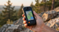
When it comes to backcountry navigation, choosing the right handheld GPS can make all the difference. The Garmin GPSMAP 67i stands out as the best overall for its combination of ruggedness, satellite communication, and detailed mapping. For those prioritizing lightweight design, the Garmin inReach Mini 2 offers reliable satellite connectivity in a compact form. Meanwhile, the Garmin eTrex 32x provides excellent value with multi-GNSS support and rugged durability. The main tradeoffs in this category usually involve balancing features like satellite communication, battery life, and ease of use. Continue reading for a detailed breakdown of these top options and what makes each unique.
Key Takeaways
- Top-ranking models combine multi-GNSS support with rugged durability for reliable backcountry use.
- Satellite communication features like inReach are essential for remote areas but add to cost and complexity.
- Battery life varies widely; some units last over 20 hours, critical for multi-day trips.
- Ease of use and interface design significantly impact usability in high-stress situations.
- Price ranges reflect differences in features such as mapping detail, satellite tech, and build quality.
| Garmin inReach Mini 2 Satellite Communicator, Lightweight and Compact, Orange |  | Best for Remote Communication and Emergency Support | Special Features: Bluetooth | Water Resistance: Yes | Battery Life: Up to 14 days in 10-minute tracking mode | VIEW LATEST PRICE | See Our Full Breakdown |
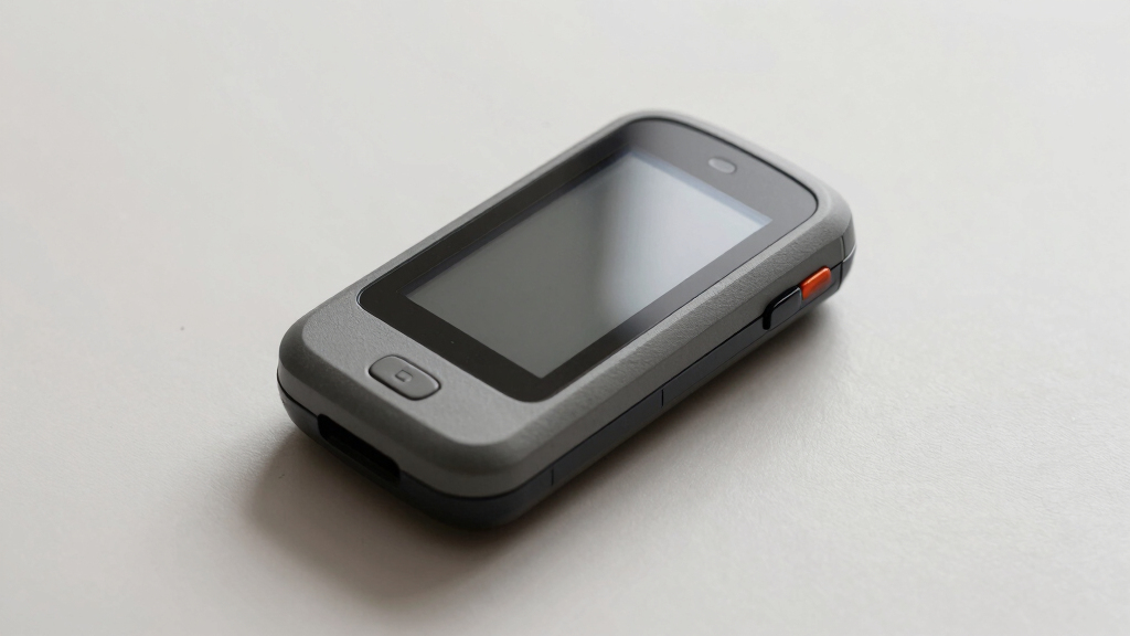
| Garmin GPSMAP 67i Rugged Handheld GPS with inReach Satellite Technology |  | Best for Rugged, All-in-One Navigation and Emergency Communication | Display: 3-inch sunlight-readable color display | Satellite Technology: inReach® Satellite, Iridium network | Mapping: Preloaded TopoActive, satellite imagery, Outdoor Maps+ | VIEW LATEST PRICE | See Our Full Breakdown |
| A6 Handheld GPS for Hiking, Rugged Waterproof Navigator with 20 Hours Battery, 2 Navigation Modes, 2.4″ Color Display, and GPS Compass |  | Best for Budget-Conscious Hikers and Climbing Enthusiasts | Screen Size: 2.4 Inches | Display Type: LCD | Additional Features: GPS compass, 2 navigation modes | VIEW LATEST PRICE | See Our Full Breakdown |
| Garmin GPSMAP 65 Handheld GPS with 2.6″ Color Display and Multi-Band Technology |  | Best for Challenging Environments with Enhanced Accuracy | Display: 2.6-inch color display | Satellite Support: Expanded GNSS, multi-band technology | Maps: TopoActive, federal land maps | VIEW LATEST PRICE | See Our Full Breakdown |
| Garmin inReach Mini 2 Satellite Communicator, Lightweight and Compact |  | Best for Remote Communication and Emergency SOS | Connectivity: Satellite (requires subscription) | Battery Life: Up to 14 days in tracking mode | Features: Two-way messaging, interactive SOS, TracBack routing | VIEW LATEST PRICE | See Our Full Breakdown |
| Garmin eTrex SE GPS Handheld Navigator with Extra Battery Life and Wireless Connectivity |  | Best for Extended Battery Life and Reliable Multi-GNSS Support | Display: 2.2-inch high-resolution | Battery Life: Up to 168 hours | Batteries: 2 AA batteries (not included) | VIEW LATEST PRICE | See Our Full Breakdown |
| Handheld GPS for Hiking, Waterproof and Rugged, 3.2″ Sunlight Readable Screen, Multi-GNSS Support, USA Topo Map, Extra Battery Life |  | Best for Rugged Outdoor Use and Detailed Topographical Mapping | Screen Size: 3.2 inches | Waterproof: Yes (IP66 rated) | Battery Life: 36 hours | VIEW LATEST PRICE | See Our Full Breakdown |
| Garmin eTrex 10 Worldwide Handheld GPS Navigator |  | Best Budget-Friendly, Reliable Entry-Level GPS | Display Resolution: 128 x 160 | Display Type: LCD | Battery Life: Up to 20 hours | VIEW LATEST PRICE | See Our Full Breakdown |
| Garmin GPSMAP 67i Rugged Handheld GPS with inReach Satellite Technology and Mapping Bundle |  | Best Overall for Remote Adventures | Battery Life: 425 hours | Display: 3-inch sunlight-readable color screen | Satellite Support: Multi-band GNSS (GPS, Galileo, QZSS) | VIEW LATEST PRICE | See Our Full Breakdown |
| Garmin eTrex 32x Rugged Handheld GPS Navigator |  | Best for Budget-Conscious Hikers | Display Size: 2.2 inches | Display Resolution: 240 x 320 pixels | Map Type: Topographical | VIEW LATEST PRICE | See Our Full Breakdown |
| Garmin GPSMAP 79sc Marine GPS Handheld with BlueChart g3 Coastal Charts, Rugged and Floats |  | Best for Marine and Coastal Navigation | Screen Size: 6 Inches | Display Resolution: 240 x 400 | Water Resistance: IPX6 | VIEW LATEST PRICE | See Our Full Breakdown |
| Garmin GPSMAP 65s Handheld GPS with Altimeter and Compass |  | Best for Multi-Environment Navigation | Display: 2.6-inch color display | Satellite Support: Expanded GNSS, multi-band | Maps: TopoActive, federal public land map | VIEW LATEST PRICE | See Our Full Breakdown |
More Details on Our Top Picks
Garmin inReach Mini 2 Satellite Communicator, Lightweight and Compact, Orange
The Garmin inReach Mini 2 stands out for its ultra-compact design, making it the best choice for backcountry explorers who prioritize lightweight gear while maintaining communication. Unlike the GPSMAP 67i, which offers more robust navigation features, the Mini 2 focuses on two-way satellite messaging and emergency SOS, providing peace of mind in remote areas. However, full functionality depends on an active satellite subscription, adding ongoing costs. This device excels for solo hikers or climbers venturing far from cell coverage, but its reliance on subscriptions and regulations in some regions can be a drawback. Its long battery life and Bluetooth sync with Garmin Explore make it ideal for extended trips without adding weight to your pack.
Pros:- Lightweight and pocket-sized, easy to carry on long trips
- Global two-way messaging and interactive SOS for safety
- Long battery life up to 14 days in tracking mode
- Seamless Bluetooth connection with Garmin Explore app
Cons:- Requires active satellite subscription for full features
- Limited navigation capabilities compared to dedicated GPS units
- Some regions restrict or regulate satellite communication devices
Best for: Backcountry adventurers who need reliable satellite communication for safety and trip coordination.
Not ideal for: Users seeking detailed mapping or navigation features without a subscription requirement.
- Special Features:Bluetooth
- Water Resistance:Yes
- Battery Life:Up to 14 days in 10-minute tracking mode
- Active Satellite Subscription Required:Yes
Bottom line: This device is perfect for solo hikers and climbers who prioritize safety and lightweight gear over detailed navigation.
Garmin GPSMAP 67i Rugged Handheld GPS with inReach Satellite Technology
The GPSMAP 67i combines rugged durability with comprehensive navigation and satellite communication, placing it among the most capable handhelds for serious backcountry trips. Its large, sunlight-readable display surpasses the smaller screens of models like the A6, providing clear maps and data in bright conditions. The device offers detailed TopoActive maps, satellite imagery, and an impressive battery life supporting extended excursions—up to 165 hours in tracking mode. Unlike the inReach Mini 2, it includes built-in navigation features, but its higher price and complex interface can be barriers for casual users. It’s best suited for explorers who need both advanced mapping and emergency features in harsh environments.
Pros:- Rugged, durable construction for harsh conditions
- Long battery life for multi-day trips
- Built-in detailed maps and satellite imagery
- Global satellite communication for tracking and emergencies
Cons:- High cost may limit accessibility for some users
- Requires subscription for satellite messaging and SOS
- Complex features with a learning curve
Best for: Experienced backcountry travelers requiring detailed mapping, long battery life, and satellite communication in rugged terrain.
Not ideal for: Casual hikers or those on a tight budget who only need basic navigation without extensive mapping or satellite communication.
- Display:3-inch sunlight-readable color display
- Satellite Technology:inReach® Satellite, Iridium network
- Mapping:Preloaded TopoActive, satellite imagery, Outdoor Maps+
- Battery Life:Up to 165 hours in tracking mode, 425 hours in expedition mode
- Connectivity:Wi-Fi, smartphone pairing
- Emergency Features:Interactive SOS, Garmin Response℠
Bottom line: Ideal for serious outdoor enthusiasts who need a tough, feature-rich device with navigation and emergency support in remote areas.
A6 Handheld GPS for Hiking, Rugged Waterproof Navigator with 20 Hours Battery, 2 Navigation Modes, 2.4″ Color Display, and GPS Compass
The A6 handheld GPS provides a solid, affordable option for hikers and climbers who need reliable navigation without extra frills. Its rugged, waterproof build ensures durability in outdoor conditions, and the 20-hour battery life supports full-day excursions. Unlike the GPSMAP 65, which offers multi-band satellite support for more challenging environments, the A6 relies on standard GPS, making it less precise in difficult terrains. It lacks preloaded maps, so users must plan routes beforehand, but its waypoint and track features are straightforward and effective for basic navigation. This pick is best for those who prioritize simplicity and durability over advanced mapping features.
Pros:- Rugged, waterproof, suitable for harsh conditions
- Long battery life of up to 20 hours
- Supports multiple satellite systems for accuracy
- Simple, intuitive navigation features
Cons:- No preloaded maps or detailed routing
- Requires clear sky for satellite signal acquisition
- Limited to basic navigation without mapping capabilities
Best for: Budget-minded hikers, climbers, or outdoor enthusiasts seeking durable navigation without needing detailed maps or multi-band technology.
Not ideal for: Users requiring advanced mapping, satellite imagery, or multi-GNSS support for complex terrains.
- Screen Size:2.4 Inches
- Display Type:LCD
- Additional Features:GPS compass, 2 navigation modes
- Battery Life:20 Hours
- Supported Satellite Systems:GPS, Galileo, BeiDou, QZSS
- Water Resistance:Waterproof
Bottom line: This device is well-suited for outdoor users who need a tough, straightforward GPS for day trips and basic navigation without the complexity of mapping features.
Garmin GPSMAP 65 Handheld GPS with 2.6″ Color Display and Multi-Band Technology
The GPSMAP 65 is tailored for backcountry explorers who face challenging environments where standard GPS may falter. Its large, sunlight-readable 2.6-inch display offers better visibility than smaller screens like the A6, and its multi-band GNSS support significantly improves positional accuracy in dense forests or steep terrains. While it lacks the comprehensive mapping of the GPSMAP 67i, it still provides essential topo maps and land detail, making it an accessible yet capable choice for serious hikers. Its button interface may feel less modern but ensures durability and reliability. However, full use of its features depends on pairing with a smartphone and doesn’t include satellite communication, limiting emergency options compared to more advanced models.
Pros:- Large, easy-to-read display in bright conditions
- Enhanced accuracy with multi-band GNSS support
- Includes detailed topographic maps
- Durable, button-operated design
Cons:- No built-in satellite communication for emergencies
- Limited to U.S. public land maps
- Requires pairing with a smartphone for some features
Best for: Backcountry users who need precise positioning in difficult terrains without the expense of satellite communication features.
Not ideal for: Users requiring built-in satellite messaging, emergency SOS, or extensive mapping in one device.
- Display:2.6-inch color display
- Satellite Support:Expanded GNSS, multi-band technology
- Maps:TopoActive, federal land maps
- Connectivity:Compatible with Garmin Explore app
- Water Resistance:Yes
Bottom line: This model is ideal for experienced hikers needing multi-band accuracy in challenging environments without satellite communication features.
Garmin inReach Mini 2 Satellite Communicator, Lightweight and Compact
The Garmin inReach Mini 2 stands out for users who need reliable two-way messaging and emergency features in the backcountry. Compared to traditional GPS units like the Garmin eTrex SE, it emphasizes communication rather than navigation alone. Its compact, lightweight design makes it ideal for minimalist adventurers, and with up to 14 days of battery life, it can sustain multi-day trips without worry. However, it requires an active satellite subscription to unlock full messaging and SOS capabilities, which adds ongoing costs. While it excels in safety features and sharing your location, it doesn’t offer detailed maps or navigation on its own—those features are accessed via pairing with a smartphone or Garmin Explore app. This makes it perfect for backcountry explorers who prioritize safety and connectivity over detailed mapping.
Pros:- Extremely compact and lightweight for easy carry
- Long battery life up to 14 days in tracking mode
- Supports interactive SOS and real-time location sharing
- Pairs seamlessly with smartphones and Garmin Explore app
Cons:- Requires a paid satellite subscription for full functionality
- Limited mapping or navigation capabilities onboard
- Some features restricted or limited in certain regions
Best for: Backcountry travelers who need a lightweight device for emergency communication and basic location sharing
Not ideal for: Hikers who require detailed offline maps and navigation without recurring subscription costs
- Connectivity:Satellite (requires subscription)
- Battery Life:Up to 14 days in tracking mode
- Features:Two-way messaging, interactive SOS, TracBack routing
- Compatibility:Pairs with Garmin devices and smartphone
Bottom line: This device is best suited for backcountry users who prioritize safety, communication, and minimal weight over detailed navigation features.
Garmin eTrex SE GPS Handheld Navigator with Extra Battery Life and Wireless Connectivity
The Garmin eTrex SE offers a compelling balance between durability, battery longevity, and multi-system support, making it a strong choice for longer backcountry trips. Compared to the Garmin inReach Mini 2, which focuses on communication, the eTrex SE emphasizes rugged navigation with a high-resolution sunlight-readable display and support for GPS, GLONASS, Galileo, BeiDou, and QZSS. Its impressive 168 hours of battery life ensures it can handle multi-day adventures without frequent recharging, but its small 2.2-inch screen limits detailed map viewing—less ideal for those needing comprehensive mapping. It also only supports North American regions, which can be restrictive for international travelers. Still, its durability and multi-GNSS support make it a reliable choice for those who want a straightforward, rugged device for navigation and geocaching.
Pros:- Exceptional battery life up to 168 hours
- Supports multiple satellite systems for high accuracy
- Rugged, water-resistant design for tough conditions
- Wireless updates and geocaching support via Garmin Explore app
Cons:- Small display limits map detail and ease of use
- Requires 2 AA batteries (not included), which can be inconvenient
- Limited to North American regions
Best for: Backcountry explorers needing long-lasting, multi-system GPS support in rugged environments
Not ideal for: Users seeking extensive mapping features or international coverage in a lightweight device
- Display:2.2-inch high-resolution
- Battery Life:Up to 168 hours
- Batteries:2 AA batteries (not included)
- Water Resistance:IPX7
- Connectivity:Wireless via Garmin Explore
- Supported Satellite Systems:GPS, GLONASS, Galileo, BeiDou, QZSS
Bottom line: This device is perfect for backcountry users who need a durable, long-lasting GPS with multi-GNSS support for extended trips in North America.
Handheld GPS for Hiking, Waterproof and Rugged, 3.2″ Sunlight Readable Screen, Multi-GNSS Support, USA Topo Map, Extra Battery Life
This rugged GPS excels for serious hikers and outdoor enthusiasts who need reliable, detailed topographical maps. Its 3.2-inch sunlight-readable screen offers a significant upgrade over smaller displays like the Garmin eTrex SE, making map reading and route planning more straightforward in bright conditions. Its waterproof, rugged construction and anti-slip design ensure durability in harsh environments. Supporting multiple satellite systems, it provides high positional accuracy, and with up to 36 hours of battery life, it’s ideal for long outings. The preloaded USA Topo maps add value for navigating in remote areas. However, the non-touchscreen interface can feel less intuitive than modern models, and its USB-C charging port may be inconvenient for some users. It’s best suited for backcountry explorers who prioritize ruggedness and detailed terrain info over sleekness or touch navigation.
Pros:- Bright, sunlight-readable 3.2″ display
- Supports multiple satellite systems for accurate positioning
- Long battery life of up to 36 hours
- Preloaded with USA Topo maps for detailed terrain navigation
Cons:- Non-touchscreen interface may be less intuitive
- Requires USB-C charger, which might not be universal
- Limited to handheld use, not suitable for vehicle mounting
Best for: Backcountry hikers and campers needing rugged, map-rich navigation with long battery life
Not ideal for: Casual users or those preferring touchscreen interfaces or international coverage
- Screen Size:3.2 inches
- Waterproof:Yes (IP66 rated)
- Battery Life:36 hours
- Map Types:Topographical
- Supported Satellite Navigation Systems:GPS, GALILEO, BEIDOU, QZSS
- Additional Features:Physical buttons, sunlight readable, anti-slip
Bottom line: This GPS is well-suited for rugged outdoor adventures where detailed topo maps and durability are priorities.
Garmin eTrex 10 Worldwide Handheld GPS Navigator
The Garmin eTrex 10 offers an affordable, straightforward solution for backcountry navigation, especially for beginners or casual users. Its monochrome 2.2-inch display provides basic map viewing and waypoint management, which is less detailed compared to color screens but remains functional in bright sunlight. Its support for GPS and GLONASS enhances positional accuracy, and with up to 20 hours of battery life, it can handle day-long excursions. Despite its simplicity, the eTrex 10 is waterproof and durable, making it suitable for rugged outdoor use. However, its small, monochrome screen limits map detail and ease of navigation, and it lacks internal storage, relying on external or preloaded maps. This makes it best for those on a tight budget or beginners seeking a reliable, no-frills GPS.
Pros:- Affordable and easy to operate
- Waterproof and durable for tough conditions
- Supports GPS and GLONASS for better positioning
- Long battery life up to 20 hours
Cons:- Small monochrome display limits map detail
- Limited internal storage (6 MB), no onboard maps
- Requires AA batteries, which may be inconvenient
Best for: Budget-conscious beginners and casual outdoor enthusiasts needing basic navigation
Not ideal for: Experienced hikers or those requiring detailed maps and advanced features
- Display Resolution:128 x 160
- Display Type:LCD
- Battery Life:Up to 20 hours
- Waterproof:IPX7
- Supported Satellite System:GPS, GLONASS
- Map Types:Worldwide basemap
Bottom line: This device is ideal for beginners or budget users seeking a simple, reliable GPS for basic navigation in the backcountry.
Garmin GPSMAP 67i Rugged Handheld GPS with inReach Satellite Technology and Mapping Bundle
The Garmin GPSMAP 67i stands out as the most comprehensive option for backcountry explorers needing both navigation and communication. Its rugged design and multi-band GNSS support ensure reliable positioning in the most challenging terrains, outperforming models like the Garmin eTrex 32x in terms of durability and accuracy. The inclusion of inReach satellite technology provides two-way messaging and SOS, making it ideal for solo expeditions or areas without cell service. However, this comes with a higher price tag and the need for an active subscription, which could be a barrier for casual users. Its large sunlight-readable display and extensive accessories support extended trips, but the setup process may be complex for newcomers. If your plans involve remote, communication-intensive adventures, this device offers unmatched peace of mind.
Pros:- Rugged, weatherproof design suitable for harsh conditions
- Supports multi-band GNSS for superior accuracy
- Includes inReach satellite communication for messaging and SOS
- Preloaded with detailed TopoActive maps
Cons:- High price point compared to basic GPS units
- Active subscription required for satellite features
- Complex setup may be intimidating for beginners
Best for: Backcountry travelers who venture into remote areas and need reliable navigation plus satellite communication.
Not ideal for: Casual hikers or weekend campers who prefer simple GPS devices without subscription costs or extensive features.
- Battery Life:425 hours
- Display:3-inch sunlight-readable color screen
- Satellite Support:Multi-band GNSS (GPS, Galileo, QZSS)
- Connectivity:Wi-Fi, inReach satellite network
- Maps:Preloaded TopoActive maps, downloadable high-res maps
- Included Accessories:USB charging adapters, microfiber cloth, P-Bank battery, microSDHC 32GB card
Bottom line: This device is best suited for serious backcountry explorers who need reliable navigation and communication in extreme environments.
Garmin eTrex 32x Rugged Handheld GPS Navigator
The Garmin eTrex 32x is an excellent choice for those seeking a durable, reliable GPS that balances features with affordability. Its rugged construction ensures it withstands tough outdoor conditions better than lighter, less sturdy models, making it comparable yet more affordable than the Garmin GPSMAP 65s. The 2.2-inch sunlight-readable display is smaller than some competitors but still clear enough for most outdoor use. It supports both GPS and GLONASS satellite systems, which improves accuracy in dense cover or steep terrain, outpacing basic models like the eTrex 10. Battery life of up to 25 hours is impressive for its size, though it requires 2 AA batteries, which might be inconvenient on long trips. This device is ideal for budget-minded hikers who want dependable navigation without extra frills.
Pros:- Durable, waterproof design suited for rugged outdoor use
- Supports GPS and GLONASS for better accuracy in challenging environments
- Long battery life of up to 25 hours
- Preloaded with detailed Topo Active maps
Cons:- Requires 2 AA batteries, which may be less convenient
- Small display size could be hard to read for some users
- Limited to handheld use, no touchscreen or smartphone connectivity
Best for: Hikers and cyclists seeking a rugged, reliable GPS with long battery life at an affordable price.
Not ideal for: Casual users who prefer a larger screen or advanced mapping features; those who want a built-in rechargeable battery.
- Display Size:2.2 inches
- Display Resolution:240 x 320 pixels
- Map Type:Topographical
- Memory Storage:8 GB
- Battery Life:Up to 25 hours
- Supported Satellite Systems:GPS and GLONASS
Bottom line: This model makes the most sense for budget-conscious outdoor enthusiasts who prioritize durability and reliable tracking over advanced features.
Garmin GPSMAP 79sc Marine GPS Handheld with BlueChart g3 Coastal Charts, Rugged and Floats
The Garmin GPSMAP 79sc excels in marine environments, combining ruggedness with advanced coastal chart navigation. Its large 6-inch display offers clear, detailed maps, surpassing smaller devices like the GPSMAP 65s in visual clarity for marine use. The device’s water resistance and floating capability add to its outdoor versatility, while preloaded BlueChart g3 coastal charts provide detailed navigation along coastlines. It supports multiple satellite systems for precise positioning, outperforming general-purpose handhelds for marine-specific needs. The touchscreen interface simplifies route planning, though wet conditions can sometimes challenge control. With a long 20-hour battery life and capacity for thousands of waypoints and routes, this device is perfect for boaters or coastal explorers, but it’s less suitable for purely land-based backcountry hiking without marine features.
Pros:- Large, high-resolution color display suitable for detailed mapping
- Supports multiple satellite systems for accurate positioning
- Preloaded with BlueChart g3 coastal charts
- Floats and is water-resistant for marine environments
Cons:- High price compared to general hiking GPS devices
- Limited to marine and coastal navigation, not for land-only activities
- Touchscreen controls may be tricky in wet conditions
Best for: Marine explorers or coastal adventurers requiring a rugged, water-resistant GPS with detailed charts.
Not ideal for: Land-only hikers or campers who don’t need marine charts or water resistance features.
- Screen Size:6 Inches
- Display Resolution:240 x 400
- Water Resistance:IPX6
- Memory Storage:8 GB
- Battery Life:Up to 20 hours
- Supported Satellite Constellations:GPS, GLONASS, Beidou, Galileo, QZSS, SBAS
Bottom line: This device is ideal for boaters or coastal hikers who need a durable, feature-rich GPS tailored for marine navigation.
Garmin GPSMAP 65s Handheld GPS with Altimeter and Compass
The Garmin GPSMAP 65s offers a balanced mix of features tailored for varied outdoor environments, making it a strong contender for general backcountry use. Its 2.6-inch sunlight-readable display outshines smaller screens like the eTrex 32x, providing clearer maps and data. The multi-band GNSS and support for multiple satellite systems ensure precise positioning in challenging terrains, similar to the GPSMAP 67i but without satellite communication capabilities. The inclusion of a 3-axis compass and barometric altimeter enhances navigation accuracy, especially when map reading isn’t possible. However, it relies on a smartphone app for full functionality, which could complicate use for some. Its U.S.-focused maps limit global applicability, but for U.S. backcountry trips, this device delivers reliable, versatile navigation.
Pros:- Bright, easy-to-read display
- Supports multi-band GNSS for high accuracy
- Includes compass and barometric altimeter
- Preloaded with detailed topographic maps
Cons:- Requires a smartphone for full feature use
- Limited to U.S. public land maps
- May be complex for casual users unfamiliar with advanced features
Best for: Backcountry enthusiasts who want a capable device for multi-environment navigation within the U.S.
Not ideal for: Global travelers or those requiring satellite communication; casual day hikers who prefer simpler devices.
- Display:2.6-inch color display
- Satellite Support:Expanded GNSS, multi-band
- Maps:TopoActive, federal public land map
- Features:3-axis compass, barometric altimeter
- Connectivity:Garmin Explore app
Bottom line: This device is well-suited for U.S.-based backcountry users who need reliable multi-satellite support and detailed maps without the expense of satellite communication features.

How We Picked
I evaluated these handheld GPS units based on core criteria crucial for backcountry navigation, including accuracy, durability, battery life, ease of use, and feature set. Each product was assessed for its ability to withstand harsh outdoor conditions, support multiple satellite systems, and provide reliable connectivity. Cost-effectiveness was also considered, ensuring options cater to different budgets while maintaining essential functionality. The ranking reflects a balance of performance, versatility, and user experience, with the top picks excelling across these areas while tradeoffs are acknowledged in lower-ranked options.Factors to Consider When Choosing Best Handheld GPS For Backcountry Navigation
Choosing the best handheld GPS for backcountry navigation requires considering several key factors. Beyond basic features, understanding how each element impacts your outdoor experience can help prevent costly mistakes and ensure your device meets your specific needs. From durability to satellite tech, each factor plays a role in determining the right fit for your adventures.Durability and Build Quality
Backcountry environments demand rugged devices that can withstand drops, water, and extreme weather. Look for units with MIL-STD or IP ratings, as these indicate resistance to shocks, water, and dust. Cheaper models may skimp on these protections, risking failure when you need the device most. Investing in a rugged GPS often pays off through longevity and reliable performance in harsh conditions.
Satellite Support and Connectivity
Multi-GNSS support (GPS, GLONASS, Galileo) improves positioning accuracy, especially in challenging terrains like dense forests or deep valleys. Devices with inReach or similar satellite communication features add safety by enabling messaging and SOS functions in remote areas. However, these features usually come with higher costs and shorter battery life—consider your trip duration and safety needs before prioritizing satellite tech.
Battery Life
Long-lasting battery life is essential for multi-day outings. Look for units that offer at least 12-20 hours of operation on a single charge, especially if you plan extended trips without charging options. Some models have replaceable batteries, which can be advantageous, while others offer rechargeable batteries with power-saving modes. Balancing battery life with features like screen brightness and GPS update rate can influence overall performance.
Ease of Use and User Interface
In critical moments, a straightforward interface with large, clear screens and simple menus is invaluable. Devices with intuitive controls reduce the risk of missteps during stressful situations. Consider models that offer customizable screens, clear topographic maps, and quick access to key functions. Avoid overly complex units if you prefer quick, instinctive operation over extensive customization.
Mapping and Navigation Features
Preloaded maps, topographic detail, and the ability to download custom maps enhance navigation precision. Some units excel with detailed topo maps, while others rely on basic waypoint functions. If you’re venturing into unfamiliar terrain, investing in a device with comprehensive mapping capabilities can significantly improve safety and confidence. Be aware that more detailed maps may increase device cost and storage needs.
Frequently Asked Questions
How important is satellite communication for backcountry navigation?
Satellite communication features like inReach provide crucial safety benefits by enabling emergency SOS and messaging when outside cell coverage. For remote trips, this capability adds peace of mind, but it often increases device cost and reduces battery life. If your outings are in well-mapped areas with cell coverage, a GPS without satellite comms might suffice, saving money and extending battery life.
Can I rely solely on GPS for navigation in the backcountry?
While modern GPS units are highly accurate, relying solely on electronic devices poses risks, especially if batteries die or the device malfunctions. It’s wise to carry backup navigation tools like a paper map, compass, or altimeter. Combining traditional navigation methods with your GPS enhances safety by providing multiple ways to find your way in unpredictable conditions.
What’s the best way to extend battery life during multi-day trips?
To maximize battery life, choose units with large capacity batteries or replaceable batteries. Reduce screen brightness, turn off non-essential features, and use power-saving modes when possible. Carrying portable power banks or spare batteries can also provide extra runtime, ensuring your device remains functional throughout your trip without interruption.
Is it worth paying extra for advanced mapping features?
Investing in detailed mapping can significantly improve navigation and safety, especially in complex terrains. However, if your trips are short or in familiar areas, basic waypoint and track functions may suffice. Weigh the added cost against your specific needs and trip complexity to determine if premium maps justify the expense.
How do ruggedness and water resistance impact device choice?
Devices designed for tough environments prevent damage from drops, shocks, and water exposure. Look for IP ratings or MIL-STD certifications, which indicate resistance levels. Choosing a rugged, water-resistant model minimizes the risk of device failure, making it a smart investment for serious outdoor enthusiasts who encounter unpredictable weather and rough handling.
Conclusion
For most backcountry explorers, the Garmin GPSMAP 67i offers the best overall experience, combining durability, satellite communication, and detailed maps. Those on a budget or who prioritize simplicity may find the Garmin eTrex 32x to be a reliable, cost-effective choice. If safety and communication are paramount, the Garmin inReach Mini 2 provides compact satellite connectivity without sacrificing too much in usability. Beginners should look for models with intuitive interfaces, while advanced users may want options with extensive mapping features. Ultimately, your choice depends on your specific adventure needs and safety priorities.